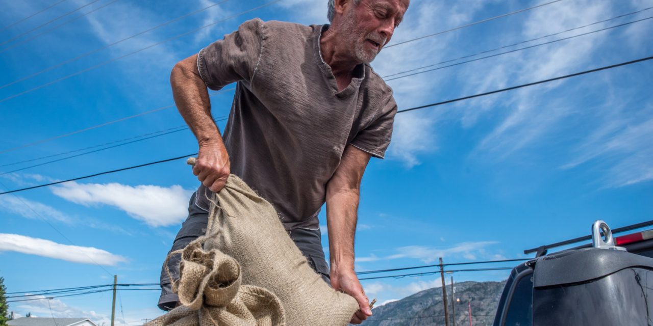
Jamie Graham, a long-time resident of Lakeshore Drive, loads sandbags into his truck. (Richard McGuire photo)
This story has been updated with developments over the weekend.
Osoyoos residents have been busy sandbagging as Osoyoos Lake’s level surpassed the benchmark of 914 feet above sea level late last week.
Although the lake’s level has fallen slightly after reaching a peak of 914.33 feet on Friday morning, as of Tuesday morning it was at 914.28 feet and rising again.
“Everyone in low areas by the lake should be sandbagging now for precautionary measures,” Janette Van Vianen, Town of Osoyoos director of corporate services and emergency program co-ordinator said Thursday. “The lake is still rising and will continue to rise as the snowpack going into the Similkameen (River) continues.”
The International Joint Commission (IJC) said in a statement Thursday that Osoyoos Lake’s level could exceed the 915.09 feet experienced in May of 1997.
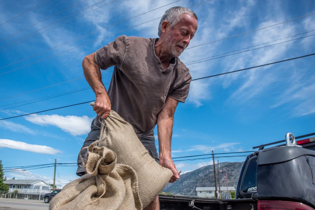
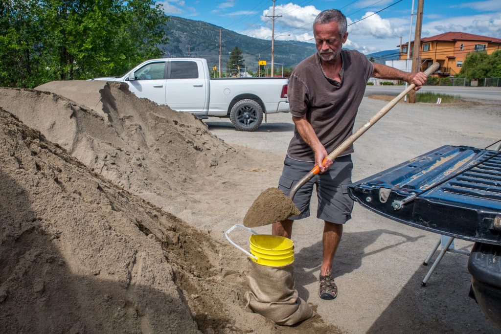
Jamie Graham, a long-time resident on Lakeshore Drive, was filling sandbags Thursday morning across Highway 3 from Dairy Queen, where the Town of Osoyoos has made sand available.
He’d cut the bottom out of a bucket that he fits over the sandbag so he could fill it without a helper.
“My wife just slows me down, and you can quote me on that,” he jokes.
The water had risen to within two feet of his house foundation, he said.
“Our house is an older house, so it’s built with a lower flood plain and so are all the houses in the neighbourhood,” said Graham. “They’re all sandbagging.”
Graham said he’s only had to sandbag twice – once in the early 1970s and once in the early 2000s. He didn’t sandbag in 2013, the last year the lake caused flooding.
“Last time we didn’t and the water went down,” he said. “This time I’m doing it, so maybe the water will go down again.”
Along Lakeshore Drive, docks are pulled up and the water laps high at the shoreline, sometimes spilling onto lawns.
At Osoyoos Park at the end of Cottonwood Drive, a picnic bench sits surrounded by water.
Utility buildings around the shoreline have been sandbagged. Yellow caution tape by the bridge discourages people from walking on the unstable shoreline. And debris floats in the lake.
The beaches on hotel row are mostly submerged.
Derek Zarchukoff and Rob Cleave were also busy filling sandbags opposite Dairy Queen. Zarchukoff manages the Coast Hotel, and he went back for more bags Thursday because what he put out earlier might not be enough.
“The water is lapping up at the back pads, so we have very little beach left,” he said. “There’s a lot of garbage up on the beach.”
Zarchukoff said the water has risen higher than he initially expected, so he was adding more bags to be on the safe side.
The current flooding situation is caused by rapidly melting snowpacks at higher elevations due to recent high temperatures.
Snow basin indices released last week by the B.C. River Forecast Centre show that as of May 15, snowpack in both the Okanagan and Similkameen River basins continued to be about 50 per cent higher than normal for this time of year.
And that’s the result of a colder and wetter early spring.
“High snow basin indices for May 15 are reflective of a delay in the onset of snowmelt season this year, particularly at higher elevations, as well as higher than normal seasonal accumulations,” the River Forecast Centre said in its May 15 bulletin.
The River Forecast Centre is still maintaining a high stream flow advisory for the Okanagan and Similkameen rivers, including tributaries.
The IJC said in its statement that the Osoyoos Lake level is mandated to be maintained between 911 and 912 feet from May 1 to Sept. 15, but during periods of high runoff the lake level is allowed to exceed this range.
Under normal conditions, the lake level is regulated by the Zosel Dam in Oroville, which is operated by the Washington State Department of Ecology. Since late April, however, the gates at the dam have been fully open to allow maximum outflow from Osoyoos Lake.
“With Zosel Dam no longer restricting outflow from the lake, the level of Osoyoos Lake depends on inflow from the Okanagan River upstream and the level of the Similkameen River which, at high flows, can back up water flowing out of Osoyoos Lake,” said the IJC statement.
The problem is that inflows from the Okanagan River are largely controlled by releases from the Okanagan Lake Dam at Penticton. With water in Okanagan Lake at record levels, those releases are expected to be higher than normal well into the summer.
“Snowpack in the Similkameen basin is similarly above normal, but flow on the Similkameen River is not regulated by a dam and can increase rapidly in response to warm temperatures and rainfall events,” the IJC statement said.
Discharge of the Similkameen River measured at Nighthawk, WA peaked around midnight last Wednesday at 19,500 cubic feet per second (cfs), but then declined to 13,800 cfs on Saturday morning.
As of Tuesday morning, it was at 16,900 cfs after rising again. The record for May 25 was established in 1956 at 23,800 cubic feet per second.
Van Vianen suggested that the drop in volume on the Similkameen Thursday shouldn’t lead people to be complacent. With warmer weather, snowmelt could increase again, she said.
“Since Zosel Dam’s construction in 1987, Osoyoos Lake levels have exceeded 912 feet six times, including reaching as high as 915.09 feet in May 1997,” said the IJC statement. “Given that this year’s snow index levels for the Okanagan and Similkameen watersheds are 30 – 40 per cent higher than 1997, it’s possible that water levels on Osoyoos Lake could exceed the high water levels experienced in 1997, depending on persistence of current high temperatures.”
Van Vianen also puts this year’s runoff in perspective with previous flood years.
In 2013, the lake only reached 914.17 feet, she said, which is lower than its current level. In 2011, however, the lake reached 914.57, which is a bit higher than its recent levels.
“We saw more localized flooding and a greater need for sandbagging,” she said, referring to 2011. “Again, anyone who experienced flooding in 2011 or 2013 should be sandbagging now.”
Osoyoos residents can obtain sandbags at the Public Works yard at 11500 – 115th Street in the industrial park. Sand is available across Hwy. 3 from Dairy Queen.
Additionally, another sand location was set up Thursday at the corner of 91st Street and 87th Street north of the Osoyoos Cemetery, Van Vianen said.
“We would also like to ask for anyone wanting to help volunteer to fill sandbags to please contact the Town office or the Emergency Operations Centre at the RDOS office at 1-877-610-3737,” said Van Vianen.
“We have elderly or physically disabled people in vulnerable areas that could really use some help,” she added.
RICHARD McGUIRE
Osoyoos Times
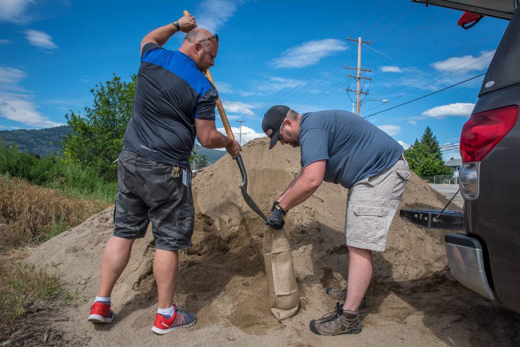
Frank Zarchukoff (left) and Rob Cleave fill sandbags where the Town has left sand across Highway 3 from the Dairy Queen. (Richard McGuire photo)
Jamie Graham, a long-time resident of Lakeshore Drive, has devised a system to fill sandbags without the use of a helper. (Richard McGuire photo)
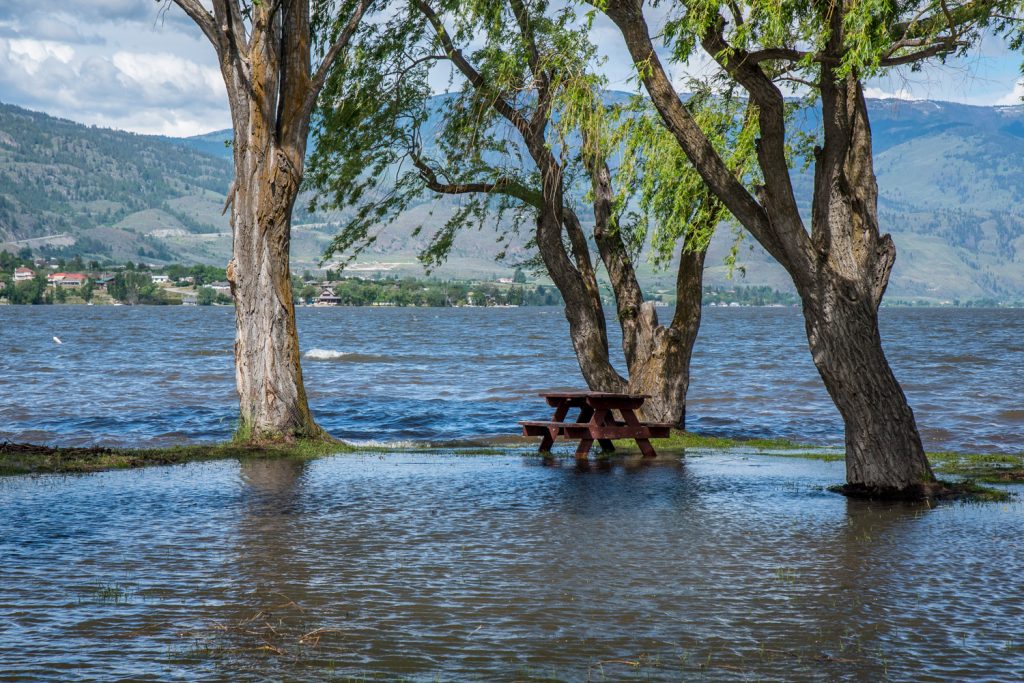
A picnic bench is surrounded by water at Osoyoos Park at the end of Cottonwood Drive. The park is currently closed. (Richard McGuire photo)
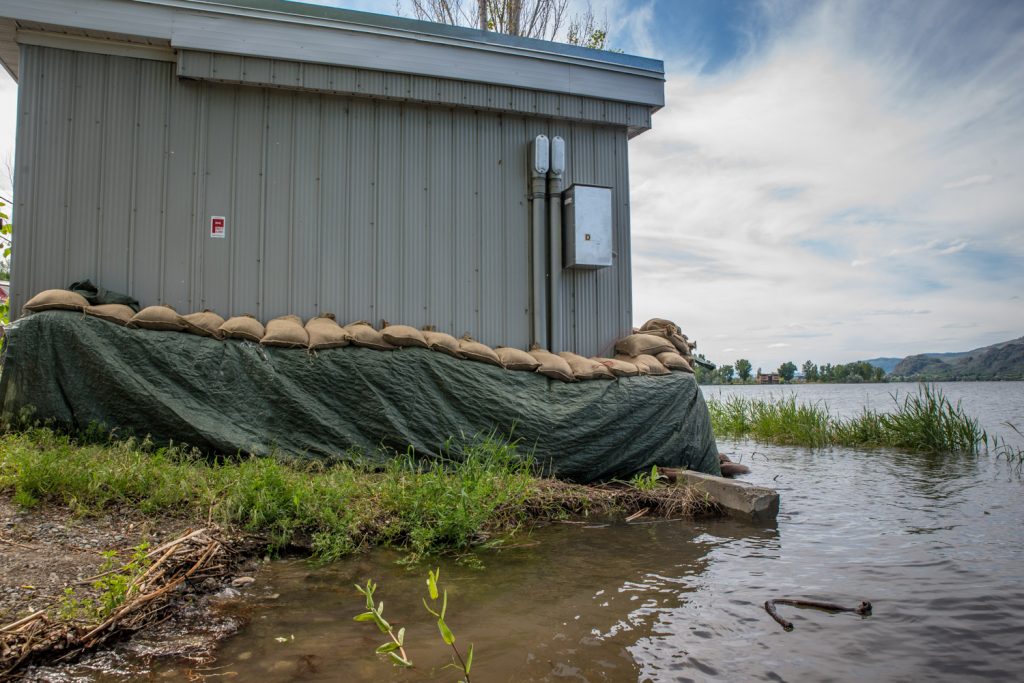
A utility building at the south end of Lakeshore Drive is sandbagged against the rising waters of Osoyoos Lake. (Richard McGuire photo)


