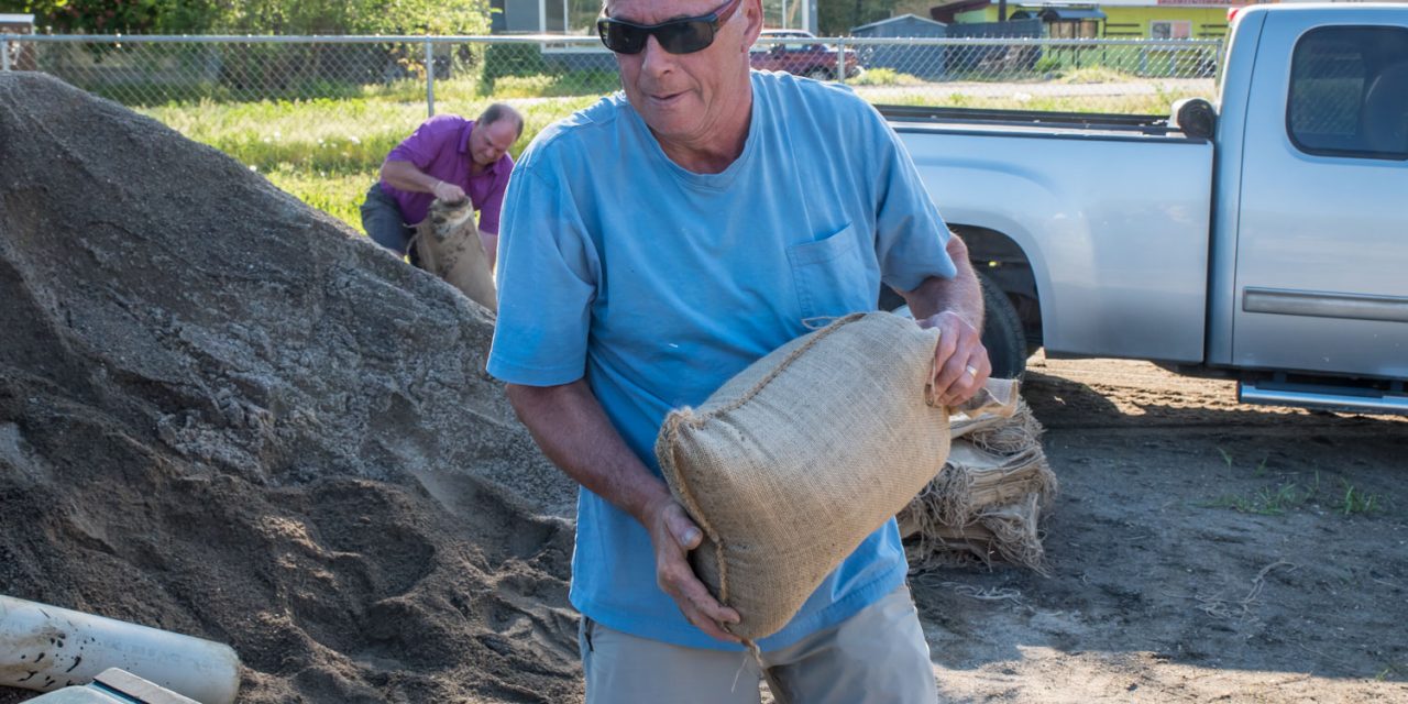

Paul Daminato loads a sandbag onto his truck while Herb Wycherley in the background fills another one. Daminato, who lives on 85th Street just north of the U.S. border, said he’s not worried about his house, but he’s concerned about damage to his retaining walls below. Wycherley, who lives on Jasmine Drive near Haynes Point, said his house is also high up, but he’s concerned about protecting the landscaping. (Richard McGuire photo)
Osoyoos residents are busy filling sandbags as Osoyoos Lake’s level rapidly rises, surpassing last year’s high level reached in early June.
As of 11 a.m. Wednesday, the lake level was at 915.12 feet above sea level – two feet higher than it was on Saturday morning when it was 913.12 feet.
On June 2, 2017, the lake reached a high of 914.89 feet, surpassing the levels reached in 2011 and 2013, and only a couple inches shy of the 915.09 reached in 1997. That 1997 peak has also now been surpassed, meaning that in recent decades, only the flood of 1972 was higher. The 1972 flood reached a peak of 917.06, nearly two feet higher than Wednesday morning’s level.
This year’s early flood threat is largely the result of record-sized snowpacks that have been melting quickly with warmer temperatures in the past two weeks.
The May 1 Snow Survey and Water Supply Bulletin, released Monday by the B.C. River Forecast Centre, showed the snow index in the Okanagan basin was 206 per cent
of normal for that date and the Similkameen was slightly higher at 210 per cent of normal.
Dave Campbell, head of the B.C. River Forecast Centre, said Monday that the Okanagan’s snow base index of 206 per cent is the highest since these records began being kept around 1980.
“It may or may not exceed the 1972 level,” he told media, referring to a record flood year. “But certainly it’s among, if not the highest, snowpack seen.”
Over the weekend, water surged down such Similkameen tributaries as the Ashnola, the Tulameen and the Pasayten, filling the main river with water and forest debris.
By 10:30 a.m. Wednesday, the Similkameen River was discharging at a rate of 27,000 cubic feet per second (cfs) as measured for the U.S. Geological Survey near Nighthawk, Washington.
That’s significantly higher than the peak of 19,200 cfs reached at the beginning of June last year and it’s almost triple the 10,800 cfs this year on May 1.
The high flows in the Similkameen act as a dam at the confluence with the Okanogan River just south of Oroville, Washington, said Al Josephy, the Washington State official who oversees the operation of the Zosel Dam in Oroville.
Currently, there is twice as much water coming into Osoyoos Lake than can exit, said Josephy in a Washington Department of Ecology news release.
The gates of the Zosel Dam have been wide open since late March, he said. This means the dam can’t control the lake level and the lake must seek its own level.
There is some positive news. The level of Okanagan Lake above Penticton is significantly lower than last year, due in part to aggressive releases of water earlier this spring, said Shaun Reimer, the B.C. official who oversees the dam at Penticton.
As of Monday, Okanagan Lake was 62 centimetres below the same day last year, he said in a media conference call.
“So we’ve certainly built in some storage capabilities this year because of the expected high runoff,” he said.
Reimer said flows of water being released from Okanagan Lake were reduced Monday to lessen the threat to communities down the Okanagan River.
“This is a short-term drop in flow reduction,” he said.
He noted that the heavy flows in Okanagan tributaries around Oliver mean there’s now much more water in the Okanagan River when it reaches Osoyoos Lake than when it leaves the dam in Penticton.
Meanwhile, on Monday the Town of Osoyoos added a third location where people can obtain sandbags and sand – at the west side of the boat trailer parking lot on Highway 3 across from Spanish Fiesta Resort.
Sandbags have been located at 87th Street and 91st Street at the bottom of Graveyard Hill since April 27 and next to Highway 3 across from Dairy Queen since March 23.
Janette Van Vianen, director of corporate services with the Town of Osoyoos, told council on Monday that she was trying to bring in filled sandbags from Oliver.
“I would say people that were almost flooding last year should probably consider sandbagging,” said Van Vianen.
She said she receives requests from residents looking for volunteers to help with sandbags.
“I have been able to put them in touch with some help, but there are people out there that will be looking, so if anybody wishes to help volunteer, if they can contact us, we can provide their information to people,” she said.
Barry Romanko, Osoyoos chief administrative officer, said the town will be monitoring lake levels. On Tuesday the town announced it is closing all town boat launches and the marina to protect the shoreline from boat wakes.
Campbell, of the River Forecast Centre, cautioned that weather this week and into next “is concerning for flood risk.”
Warmer weather at the start of this week is expected to be followed by wetter weather on Wednesday, possibly bringing significant rainfall. Then later into the week and on the weekend, a high-pressure ridge is expected to develop.
“That would transition back into that rapid melt,” he said. “This week could be another challenging week in terms of flows across the interior.”
RICHARD McGUIRE
Osoyoos Times

Herb Wycherley ties a sandbag as he loads his truck at a new sand location at the boat trailer parking lot on Highway 3 on Monday. Wycherley, who lives on Jasmine Drive near Haynes Point, said his house is high up, but he’s concerned about protecting the landscaping. (Richard McGuire photo)


