By Don Urquhart, Times Chronicle
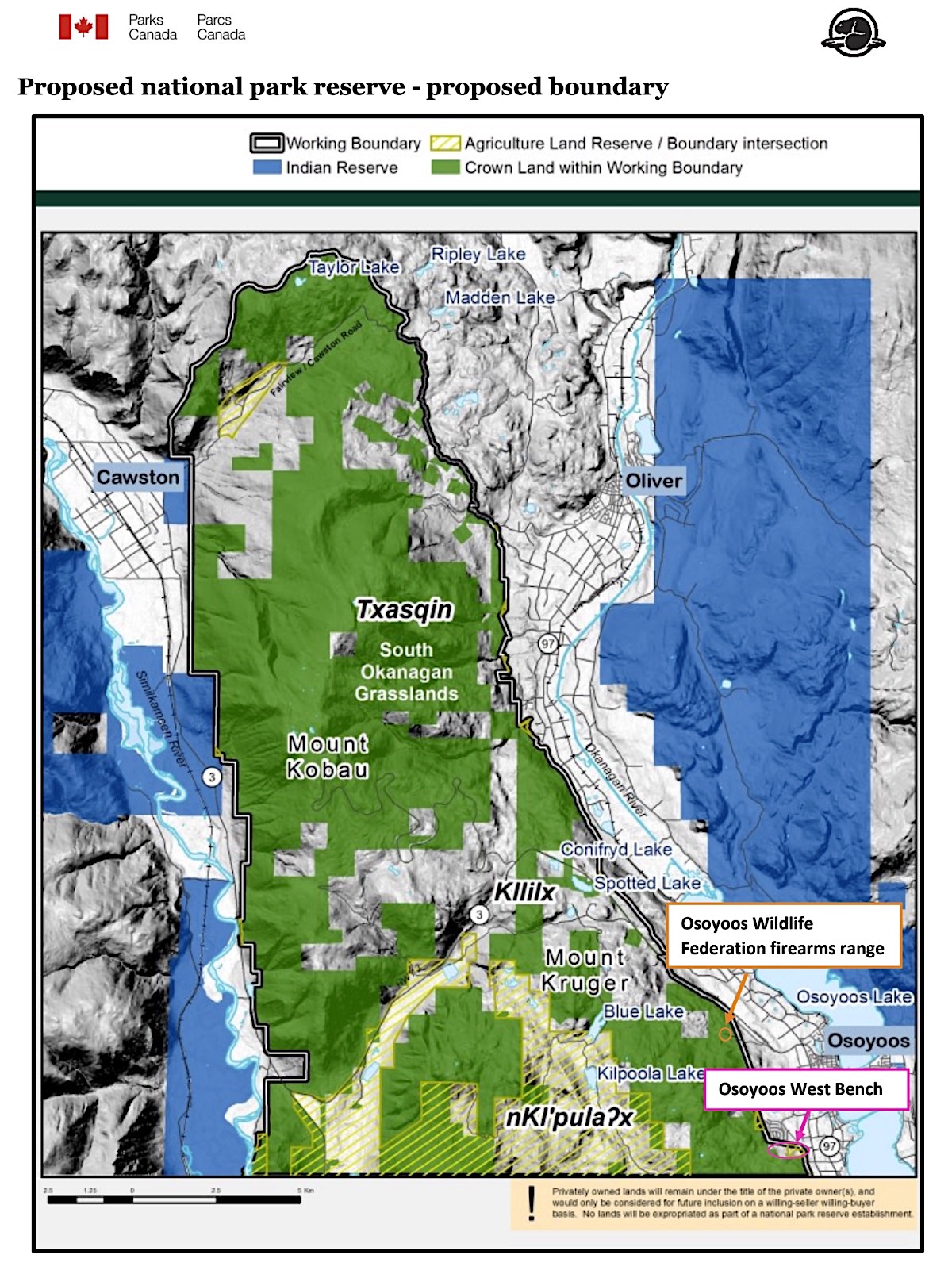
Parks Canada has updated progress on the Proposed National Park Reserve that covers areas around Mount Kruger/Kobau noting that the tripartite negotiations have, amongst other things, resolved two boundary issues pertaining to the firearms range and Osoyoos West Bench.
The current negotiation phase which started in 2020 between the three partners – Parks Canada, Government of BC and the syilx Okanagan Nation as represented by the Osoyoos Indian Band and the Lower Similkameen Indian Band – is ongoing.
In the Parks Canada update it was noted that the partners continue to meet regularly and are working on an “establishment agreement”, which will outline how they will create and manage the proposed national park reserve together.
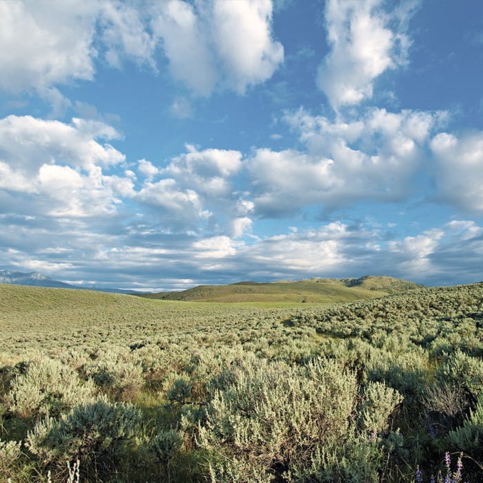
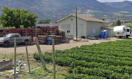
Kilpoola Grasslands.
Parks Canada photo
Boundary issues for the currently slated 273 sqkm of land (essentially unchanged from the 2018-19 public consultation) are being worked on with a confirmation in this update that the Osoyoos Wildlife Federation (OWF) firearms range has been removed from the proposed boundary. The firearms range is on Crown lands licensed to the OWF and it had requested that the facility be excluded in 2018. The TSC supported this request.
On the issue of the Osoyoos West Bench which the Town of Osoyoos had requested a portion of provincial Crown land to be removed from the proposed boundary, the TSC declined the request.
“After careful consideration and dialogue, the Town of Osoyoos and the TSC agreed in 2024 that the area should remain in the proposed boundary,” the update read.
The TSC based the decision on the fact the West Bench is a “culturally and ecologically important area,” which includes a large number of species at risk living in this area. The area also helps connect other areas of important habitat.
Other requests for small boundary changes received between 2018 and 2020 continue to be actively discussed, it said.
Parks Canada also reiterated the fact that if the proposed national park reserve is created, only provincial Crown land would be transferred to Parks Canada from the Government of British Columbia.
It added that private lands would “only ever be acquired on a willing seller-wiling buyer basis” and Parks Canada would have no jurisdiction over private lands.
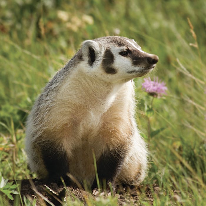
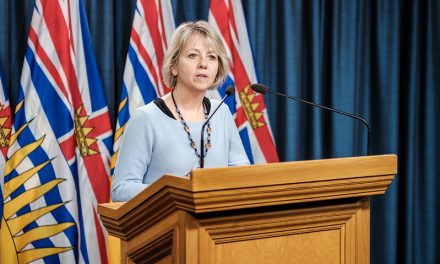
American Badger (jeffersonii subspecies).
Parks Canada photo
Also reiterated was the fact cattle grazing would continue in the park reserve.
The three partners are reviewing existing information about cattle grazing in the area and are developing recommendations on how grazing would be managed in a national park reserve scenario. A provincial Range Policy Specialist is supporting this work.
The update added that feedback from the ranching community is helping to inform the recommendations and the three partners will continue to engage with the ranching community with the aim of providing tenure holders with “stability and clarity” on grazing.
A road analysis is also underway to identify all roads and trails within the proposed boundary and is only an information gathering exercise.
The Osoyoos Indian Band and Forsite Consultants are leading this project after being selected through a competitive bidding process.
The project is occurring in collaboration with the Lower Similkameen Indian Band. The information will be shared publicly once the exercise is complete.
On July 2, 2019, the governments of Canada and British Columbia and the syilx/Okanagan Nation signed a Memorandum of Understanding to formally work toward establishing a national park reserve in the South Okanagan-Similkameen. The purpose is to protect this iconic natural and cultural landscape for future generations.
The proposed national park reserve includes 273 square kilometres covering the tx̌asqn (Mt Kobau), kɬlilxʷ (Spotted Lake), and nk̓lpulaxʷ (Kilpoola) areas of the iʔ nxʷəlxʷəltantət (South Okanagan – Similkameen) area, including BC Parks’ South Okanagan Grasslands Protected Area.
The South Okanagan-Similkameen is where the northern edge of the Great Basin Desert reaches into British Columbia, in the extreme south of the Interior Dry Plateau natural region.
This is one of 39 regions identified by Parks Canada’s national parks system plan as a distinctive component of the national landscape, and is not yet represented by a national park.
“From both national and provincial perspectives, this is an area of high conservation value and an excellent candidate area for Parks Canada to represent this region,” the national parks arm said in its background information.

