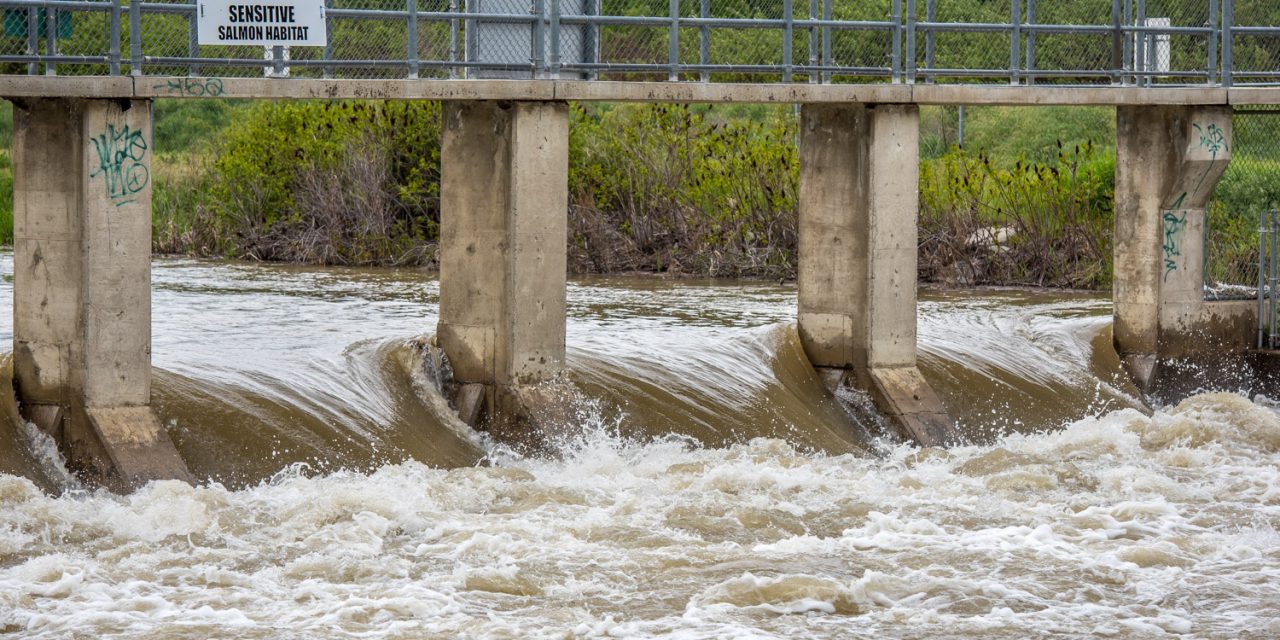
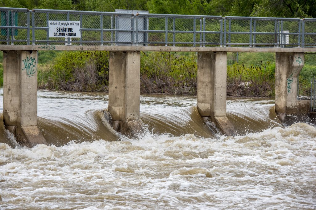
Water is high and strong at a weir on the Okanagan Channel north of Osoyoos Lake. (Richard McGuire photo)
Hot weather over the May long weekend is causing snow to melt rapidly at higher elevations, again raising the threat of floods.
Environment Canada issued a special weather statement Monday covering the entire Okanagan warning that a ridge of high pressure is causing unseasonably warm weather.
Temperatures have been in the high 20s and low 30s over the weekend.
“This warm spell will accelerate snowmelt and lead to rising rivers, possibly causing concerns related to flooding,” Environment Canada said, directing people to the B.C. River Forecast Centre for information about flood conditions.
The River Forecast Centre issued high stream-flow advisories on the weekend covering the Okanagan, Similkameen, Kettle River and their tributaries.
High-elevation snowmelt rates were expected to increase to 30-40 millimetres a day or higher through the rest of the weekend and into Tuesday.
Temperatures were then expected to cool off Wednesday, but Environment Canada predicted a 60 per cent chance of showers. The cold front could bring thundershowers.
Although the level of Osoyoos Lake only rose slightly over 913.5 feet above sea level during the weekend, high volumes of water in the Similkameen and Okanagan Rivers could still raise the lake level. As of Tuesday afternoon, Osoyoos Lake was at 913.65 feet.
Okanagan Lake has been rising closer to the 343-metre flood mark as snowpack at upper elevations melts rapidly, swelling streams.
On Sunday, Okanagan Lake rose three centimetres, and on Monday it surpassed the 1990 lake flood level of 342.87 metres, according to Central Okanagan Emergency Operations.
Water from Okanagan Lake enters the Okanagan River system at Penticton, making its way down through Skaha and Vaseux lakes to Osoyoos Lake.
Meanwhile, rapidly melting snow at higher elevations in the Similkameen River basin has caused water flows to surge again.
As of 12:30 p.m. Tuesday, the Similkameen’s discharge was 15,200 cubic feet per second as measured at Nighthawk, WA, according to the U.S. Geological Survey.
That’s a major increase from the 8,540 cubic feet per second recorded last Thursday morning.
Water from the larger Similkameen River, when it becomes too high, can back up the smaller Okanogan River at the confluence of the two rivers just south of Oroville, WA. This makes it difficult to release water from Osoyoos Lake at the Zosel Dam in Oroville.
The Department of Ecology in Washington State warned last week that during runoff season, the level of Osoyoos Lake could rise sharply and cause downstream rivers to flow more swiftly.
The level of Osoyoos Lake is regulated by the Department of Ecology at the Zosel Dam in Oroville, and currently the dam’s gates are wide open to allow the runoff to go down the Okanogan River, as the Okanagan River is called south of the border.
“When runoff is high throughout the system and the Zosel Dam gates are wide open, the lake must seek its own level,” said Al Josephy, who oversees the dam for Ecology. “When lake levels return to normal, we can regulate flows at the dam through the summer and into the fall and winter.”
With snowpack levels much higher than normal for this time of year in all watersheds in the region, Ecology intends to manage the lake level to its usual summer target of between 911.5 and 912 feet from May 1 to Sept. 15.
“During spring runoff, the lake often rises beyond 913 feet and has reached as high as 915 feet, though rarely,” Josephy said. “This can cause inconvenience and occasional flooding to property owners along the lake and down to the site of the dam itself.”
Josephy recently told the Osoyoos Times he would not be surprised to see Osoyoos Lake reach 914 feet above sea level this year.
In addition to the threat of flooding, rapid snowmelt has also swept away soil and debris, some of it entering lakes and creating a hazard for boaters.
“Debris in creeks can block culverts and divert water,” the Regional District of Okanagan-Similkameen (RDOS) warned on Sunday. “Homes and agricultural areas can be damaged and people, pets and livestock can be put at risk.”
The RDOS ask residents to report it if they see creeks moving larger branches, trees or boulders. They should contact the Provincial Emergency hotline at 1-800-663-3456. If there is an immediate risk to lives or property, then residents should phone 911.
“We’ve seen Tinhorn and Testalinden Creeks in the Oliver area release debris floods in the past weeks,” warned Dale Kronebusch, RDOS emergency service supervisor. “We could see more in this area as the 2015 forest fires weakened tree roots that hold up creek banks.”
Eleven properties along Tinhorn Creek were ordered to be evacuated on Saturday, but the evacuation order was lifted on Sunday.
A precautionary evacuation alert for 15 properties remained in effect and residents near Hester Creek were put on alert Tuesday.
Last week the Town of Osoyoos encouraged residents using sandbags to keep them in place.
Sandbags in Osoyoos are available at the Public Works yard in the industrial park at 11500 – 115th Street. They were stacked outside the gates for pick-up over the long weekend.
Sand has been placed across the street from Dairy Queen on Highway 3.
RICHARD McGUIRE
Osoyoos Times


