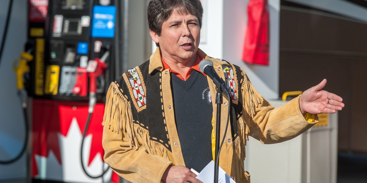
Chief Clarence Louie of the Osoyoos Indian Band speaks during the opening of Nk’Mip Corner in this file photo. (Richard McGuire file photo)
Dear Editor:
Chief Clarence Louie, Osoyoos Indian Band (OIB), provides the following response to the Letters to the Editors submitted by local residents regarding the disturbance of Okanagan ancestral remains at Haynes Point Provincial Park and the resulting archaeological investigations.
In Letters to the Editors that have been published recently, many personal opinions have been expressed. In this open letter, I will not comment on the opinions expressed, since everyone is entitled to their own opinions. But, where someone states a “fact” that is not a fact, I will respond back. There is a saying I like: “A person is entitled to their own opinions, but not their own facts.”
The most important fact that I want to emphasize right away is how old the ancestral remains turned out to be. Radiocarbon dating confirmed the ancestral remains were about 1,224 years old. This fact dates the ancestral remains to a pre-contact period, before the arrival of European settlers in the Okanagan region, British Columbia, or most of the rest of Canada.
What is the real meaning of OIB’s traditional territory?
The Osoyoos Indian Band (OIB) is an Okanagan Nation community. Our Okanagan ancestors have been here since the beginning of people on this land. The Okanagan Nation’s traditional territory covers approximately 69,000 km2. The northern area of this territory is close to the area of Mica Creek, just north of Revelstoke, BC, and the eastern boundary is Kootenay Lake.
The southern boundary extends to the vicinity of Wilbur, Washington and the western border extends into the Nicola Valley.
The OIB’s reserve lands, core territory and area of leadership responsibility (i.e. traditional territory) are located primarily in the South Okanagan and Boundary regions.
The place name for the area that is part of the present day Haynes Point Provincial Park is s-ooyous, which means the crossing at the shallow part of the lake. The area is well known among our Okanagan elders. The history of the area is embedded in our chaptikand recorded in our stories and teachings, which have been passed down for millennia.
The s-ooyous area, including Haynes Point Provincial Park,is located within the OIB’s traditional territory. The OIB holds unextinguished Aboriginal Title and Rights over its territory that are protected under section 35(1) of the Canadian Constitution Act of 1982.
Section 35(1) recognized and affirmed the existing Aboriginal and treaty rights of the Aboriginal Peoples of Canada. This past June, the highest court in Canada, the Supreme Court of Canada affirmed the Aboriginal Title claims of the Tsilhqot’in Nation in the Williams Lake area. Following this, on September 11, 2014, the Provincial government acknowledged the decision as an historic opportunity to work together to build a new path for recognition and reconciliation in the province. The Province also recognized that without question and dispute Aboriginal title exists in British Columbia.
What is happening with the investigation into the ancestral remains?
After the Okanagan ancestral remains were uncovered on April 29, 2014, OIB and BC Parks initiated a full archaeological investigation. Professional archaeologists, working with an OIB field team and Okanagan traditional experts, undertook an emergency salvage archaeology project. The field component of this project is now complete and the project is currently at the analysis and reporting phase.
A further and more comprehensive archaeological investigation is currently underway to complete an archaeological inventory and impact assessment of Haynes Point Provincial Park as a whole.
I understand that local residents are frustrated by the information that has been provided to date, but I assure local residents that full archaeological investigations have been undertaken by qualified and very experienced professional archaeologists. Since the analysis and reporting tasks for both projects are still underway, it would be irresponsible and speculative to provide further archaeological details at this time. However, the OIB remains committed to working with BC Parks to provide the public with more information in 2015.
Archaeological information from officials or sources other than OIB or BC Parks
Out of respect for our ancestor, community members and cultural protocols, OIB directed the work be carried out using the utmost respect and discretion. As such, it is very unlikely that an official member of the archaeological team provided specific details about the ancestral remains to the public.
In addition, since provincial law protects all archaeological sites in BC (whether intact or disturbed, known or unknown, recorded or unrecorded), it is extremely unlikely that a BC Parks or OIB official would have jeopardized this protection by sharing specific details about the ancestral remains. In fact, the public should take note that archaeological site information and reports are privileged documents with limited public access.
Transformation of Haynes Point Provincial Park in the mid-1960s
With respect to the transformation of parts of the s-ooyous area into Haynes Point Provincial Park, yes, the OIB is acutely aware of the land altering activities and impacts as campground and recreation facilities were established. Indeed, a quick visual survey and comparison of historical imagery indicates that wetlands were filled and knolls were levelled and, in some cases, pushed into the lake.
To be clear, a key component of the archaeological work currently underway is a study of the land altering activities in the park, particularly those activities that occurred in the 1950s and 1960s. Thus far our research findings indicate that 15,000 cubic yards of fill was brought in from a source 5.5 miles north of Osoyoos.The OIB is also aware of the rock brought in from the nearby Dividend Mine, the burning and clearing of the land on site and the planting of some 900 invasive trees. On the other hand, the OIB has not found any records that indicate fill was brought in from the Cawston area.
The OIB does not dispute the fact that land altering activities and impacts occurred. However, the Band is prepared to dispute suggestions that the “…entire area, the road, the campsites and the huge mound where the pit toilets were placed, was all land fill brought in.” In fact, the research and preliminary archaeological findings to date confirm the opposite. That is, despite the intensity of land altering activities and impacts, intact natural land formations and cultural deposits remain within the park.
Osoyoos Lake Levels and Zosel Dam
As part of the archaeological work that is underway, archaeologists are examining not only the land altering activities and impacts resulting from the campground development, but also from the artificially established Osoyoos Lake levels as a result of Zosel Dam in Oroville, Washington.
As mentioned above, Haynes Point Provincial Park is part of s-ooyous. This area was once an important cultural landscape for the Okanagan Nation. The area was also a significant transportation route for our Okanagan ancestors. The area was used to cross Osoyoos Lake by foot or by horse. That is why the area was given the important place name of s-ooyous – it is place where Okanagan People lived and crossed for millennia.
Over the years however Osoyoos Lake levels have risen and the crossing was submerged. The construction of Zosel Dam in 1927 played a significant part in this, along with subsequent and corresponding international water management decisions. Concerns about Zosel Dam causing high lake levels were recorded as early as the 1940s, with lake levels reaching a peak in 1972. Zosel Dam sustained unnaturally high lake levels in Osoyoos Lake, causing land to flood on both the Canadian and US sides of the lake. As a matter of fact, about 34.9 acres of OIB reserve land remain partially flooded or completely submerged at 7 different locations along Osoyoos Lake. In the early 1990s, the Band settled a specific claim with the federal government regarding the loss of these flooded lands.
Nonetheless, despite a history of unnaturally high lake levels and flooded land, the OIB is confident that regular flooding did not occur in the area where the ancestral remains were found.
Okanagan Ancestral Remains
When Okanagan ancestral remains are disturbed within OIB’s traditional territory, all work must stop immediately in the vicinity of the discovery. The Band and appropriate agencies are notified and investigations are then undertaken by qualified archaeologists to determine the history and meaning of the burial site. This information is used to develop a culturally appropriate management strategy.
This process was carried out with the Okanagan ancestral remains that were disturbed at s-ooyous within Haynes Point Provincial Park. In this instance, our cultural protocols dictated no further disturbance. The ancestral remains and associated artifacts were recovered from the excavation pit and prepared for reburial on site.
In some cases the OIB has been involved in the ancestor and associated artifacts required exhumation and reburial in another location. There are a number of factors that guide this decision. For instance, this may happen if the investigation reveals uncharacteristic burial customs such as during the periods starting in the 1770s through to 1832 and 1862 when various epidemics, such as smallpox, decimated our people.
Claims that no artifacts and “just a few bones” were found in the fill that was brought in
As previously mentioned, out of respect for our ancestor, community members and cultural protocols, and the need to ensure the legal protection of the ancestral remains, the OIB declined to share specific details about the ancestral remains. Nevertheless, the OIB confirms that more than “just a few bones” were recovered, along with artifacts directly associated with the burial.
Regarding claims about the depth of the ancestral remains and personal assessments that the ancestral remains were found “in the fill that was brought in” or came “from anywhere either washed in from the flood waters or dropped off by the dirt that was hauled in,” the OIB reassures local residents that during the emergency salvage work intact sediments with cultural deposits were excavated.
This information, combined with our traditional knowledge of the area and the fact that the ancestral remains were radiocarbon dated to be approximately 1,224 years old, leads us to believe that the final report on the archaeological salvage work will confirm that the ancestral remains were originally buried at s-ooyous within the present day Haynes Point Provincial Park.
In closing, the OIB extends its thanks to those who have shown interest in the archaeological work that is intended to ensure the long-term protection of the cultural heritage resources, sites and values within Haynes Point Provincial Park at s-ooyous.
Lim’lempt,
Chief Clarence Louie
Osoyoos Indian Band
