Don Urquhart
Times-Chronicle
Nk’Mip Creek wildfire fighting has taken on a sharp focus to protect key infrastructure including Hwy 3, FortisBC’s mainline power supply for Osoyoos and Oliver and important watersheds, according to the latest Emergency Operations Centre (EOC) update. This is in addition to the primary goal of safeguarding human life and property.
The issue of a highway closure as a result of the 6,800 hectare ‘out of control’ Nk’Mip Creek wildfire has been a hot topic as people clamour for clarity on the status of this vital east-west transportation link. The highway east out of Osoyoos is currently within the area covered by an evacuation order.
“There is discussion around an evacuation alert for Hwy 3 but there are no plans to close it yet,” said BC Wildfire Service (BCWS) information officer Dani McIntosh during the RDOS Emergency Operations Centre update for Friday, July 23.
She said the BCWS operations chief has identified triggers that would initiate a closure, adding that the Wildfire Service is working closely with the BC Ministry of Transportation to ensure there is ample notice in order for people to be able to get out of the area.
“It is significant and important to maintain transport corridors that we’re seeing now as being important evacuation corridors with the intense fire activity we continue to see through the central interior of BC,” said Dennis Rexin, BC Wildfire Service incident commander for the Okanagan Complex fires.
McIntosh also said that the BCWS is working closely with FortisBC who has two crews on-site monitoring the key power mainline for the two towns.
“They are doing everything they can with structural protection to make sure that line isn’t compromised,” she said, noting there has already been some damage to power lines.
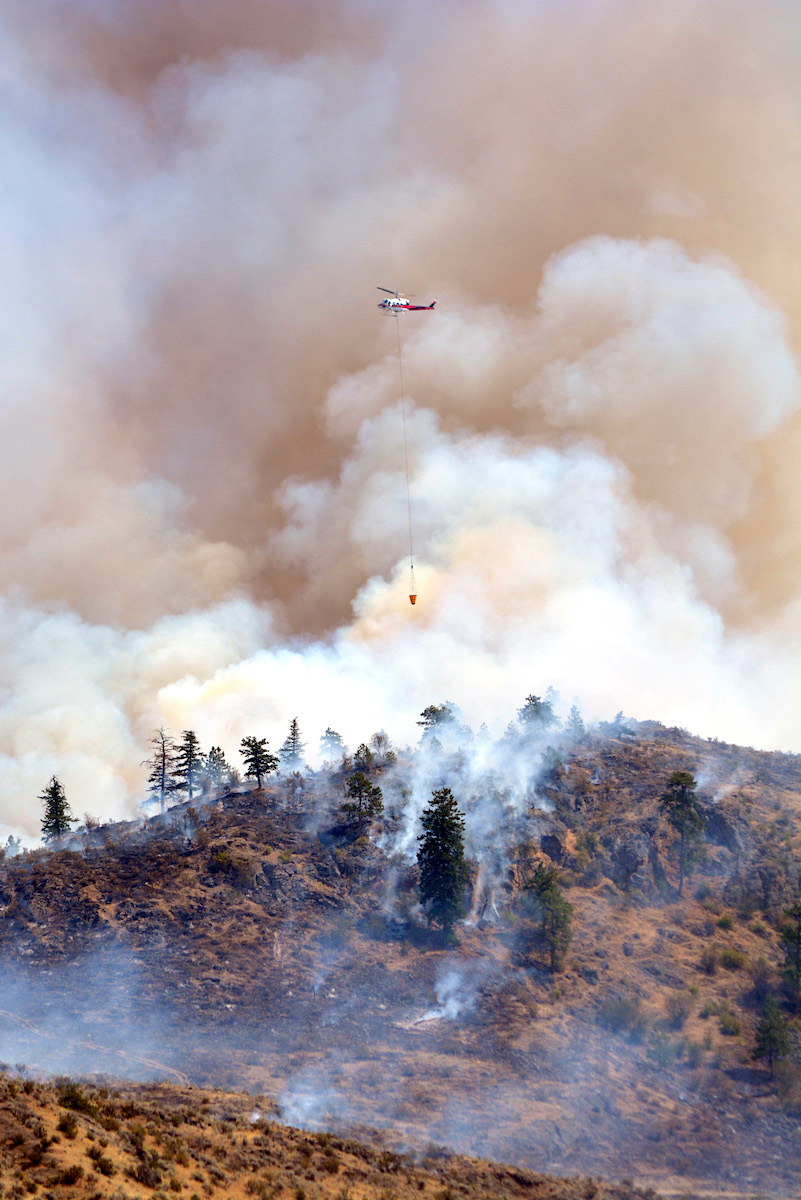
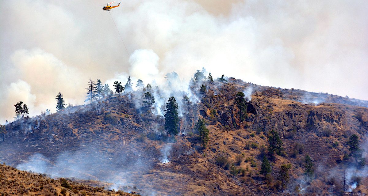
Weather conditions are expected to stay the same over the next few days which will continue the trend of winds coming out of the north, northeast at around 15 kph, changing in the afternoon with gusts up to 25-30 kph around 4 p.m. every day. Photo by Lyonel Doherty.
Bill Newell, chief administrative officer/EOC director, RDOS added that “while Hwy 3 remains open but under scrutiny,” roadblocks have been set up on each of the roads entering onto the highway with roving RCMP patrols “ensuring properties of those evacuated remain secure.”
Evolving fire
The Nk’Mip Creek fire grew significantly on the northeast and south perimeters over the last couple of days including last night with major growth at the north end near Camp Mckinney Road, the BCWS said.
Weather conditions are expected to stay the same over the next few days which will continue the trend of winds coming out of the north, northeast at around 15 kph, changing in the afternoon with gusts up to 25-30 kph around 4 p.m. every day. That combined with the hot weather is causing the fire to be more erratic and active later in the day rather than in the morning, she said.
Currently, 80 personnel and four helicopters are active on the fire along with 12 pieces of heavy equipment that are working on implementing fireguards on its eastern perimeter. The arrival of some 100 firefighters from Mexico in Oliver and Osoyoos on July 25, after arriving in Canada today, will provide some welcome support.
The fire has also claimed one house and a camper on Shrike Hill in Oliver, according to Bill Newell CAO of the RDOS and EOC director.
A total of 635 properties are on evacuation order while 1,138 are on evacuation alert as a result of the Nk’mip Creek fire. Martin Johansen, Oliver mayor said the Emergency Support Services (ESS) reception centre at the Royal Canadian Legion is experiencing high volumes due to the large number of evacuated residents. A total of 540 people have been registered at the Legion and 383 have been supported.
Penticton Indian Band extends help
Chief Greg Gabriel of the Penticton Indian Band (PIB) said the Band’s Emergency Services Group was activated Thursday night to provide support for the Osoyoos Indian Band (OIB) evacuees. The community ballpark and hall were readied to receive any evacuees that needed a place to camp or place to spend the night. Two families were received last night and have since been set up with “more appropriate accommodation”, he said.
Gabriel extended his “heartfelt thanks and praise to all the firefighters on the frontlines and all the other first responders that are keeping our community safe, I just hope and pray that everyone stays safe during these troubling times.” He also thanked the regional district and their emergency services group along with the City of Penticton who supplied 50 cots for families needing to spend the night.
“It just goes to show how great our communities can come together in the event of emergencies and support one other. I’m just amazed at the cooperation and generous support we received from outside agencies, we all appreciate that. I can’t speak on behalf of [OIB] chief Clarence Louie but I’m sure he appreciates everyone’s concerted efforts.”
Thomas Creek
On the Thomas Creek wildfire, Rexin noted responders have been working on it for quite some time and “we are continuing to make good headway with industry partners.” This includes creating additional fireguards with heavy equipment typically by widening existing forest service roads in anticipation of potential burnup operations that will be looked at on a daily basis.
“The majority of the work on the Thomas wildfire has been on the western slopes ensuring that as soon as possible we can rescind the alert that is on for the majority of the Okanagan Falls area.”
A thermal imaging drone will be used tonight to assess various areas in the hope that the restriction zone can be reduced. Additional firefighters in the form of support from the Department of National Defence will soon be joining efforts to combat the fire.
Brenda Creek
The Brenda Creek Mine Wildfire is a bit further out, Rexin noted, but it has a significant amount of infrastructure. The evacuation order and alert are still in place, he said adding that an aerial survey earlier today showed wispy, white smoke which is a positive indicator that there’s not a lot of hot fire activity.
One area of concern is the Peachland drainage area because there is not a lot of areas for firefighters to provide safe access and egress and provide containment on the fire.
Other core infrastructure the BCWS is aiming to protect in this 600 hectare fire is Hwy 97C that will provide an evacuation corridor if there is a need, between West Kelowna and Merritt.
The main wooden-polled power line transmission for BC Hydro has also seen a keen focus on sprinkler protection through mass water delivery. This can be operated at night and has allowed the powerline to be “safe and still standing” where helicopters cannot be operated under the power lines and during the night. Protecting the watershed is also a keen priority he added as are homes around Peachland and Headwater Lakes which have also received mass water delivery.


