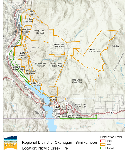
The Regional District of Okanagan Similkameen announced that properties with an Evacuation Orders in electoral area “A” and “C” have been rescinded to an Evacuation Alert.
The Area Restriction Order, on the other hand, has been updated with new boundaries. This order went into effect on Aug. 7 and will remain in place until Oct. 15 or when the order is rescinded.
This restriction area includes Crown land and where Highway 3 meets the Osoyoos Lake shoreline and the Osoyoos Indian Reserve boundary, and continues north to the Oliver fire department boundary. The restriction travels east to Conkell Creek Forest Service Road until Ripperto Forest Service Road.
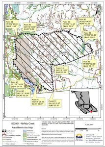
Map showing the updated Area Restriction Order for the Nk’Mip Wildfire.
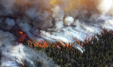
The Nk’Mip Wildfire has continued to grow, now measured at 16,877 hectares. However, the cooler weather over the weekend has allowed fire crews to get closer to the fire to manage it.
Fire crews continue to establish machine and contingency guards around the perimeter of the fire, which will be reinforced using hand and aerial ignition.
Structural protection personnel are protecting areas around McKinney Road, properties around Mt. Baldy, and other areas. Crews have demobilized structural protection equipment around Shrike Hill due to decreased fire risk in the areas.


