By Times Chronicle Staff
UPDATES (original story below)
July 9, 10:30 a.m. Update: The Regional District of Kootenay Boundary says that as forecast, favourable weather conditions last night resulted in shifting winds that blew the fire back onto itself and away from the Canada/US border.
It added that, the US has put considerable resources on the 3,200-acre fire.
July 8, 6 p.m. Update: Stevens County Emergency Management says the fire is now estimated to be 3,000 acres (1,214 hectares) in size.
July 8, 5:20 p.m. Update: As of 5:00 pm, the Hope Wildifre is currently 15 kms south of the Canada/US border according to the Regional District of Kootenay Boundary (RDKB). The BC Wildfire Service continues to monitor and share air resources and urrent weather forecasts predict a shift in wind direction tonight that will keep the fire away from the border.
July 8, 3:30 p.m. Update: The Regional District of Kootenay Boundary has activated its emergency operations centre to a level 1 to monitor the wildfire burning approximately 19 kms south of the US/Canada border.
The regional district highlighted that currently there is no threat to RDKB residents. Smoke from the fire is visible in the Lower Columbia communities and Christina Lake.
The BC Wildfire Service is sending air tankers and US air support is en route to the fire.
“We are activating out of an abundance of caution and to continue to monitor the fire,” said Mark Stephens, EOC Director for the RDKB. “With wildfire season here, we encourage residents to plan for emergencies, such as create Grab and Go kits.”
______________
Original story:
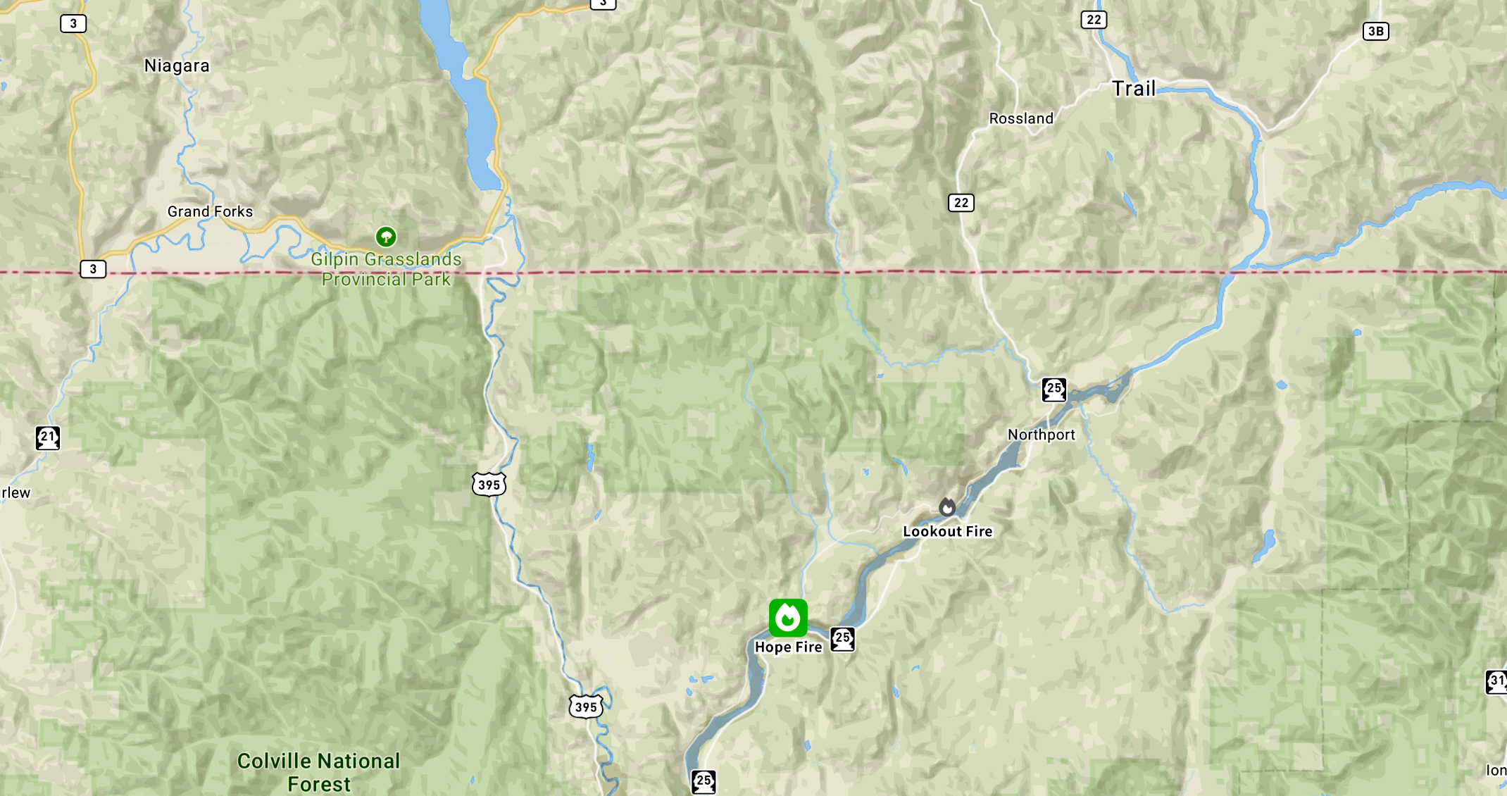
The BC Wildfire Service said Tuesday (July 8) afternoon it’s aware of the wildfire in Washington State 16 km southwest of Northport and is assisting in fire suppression.
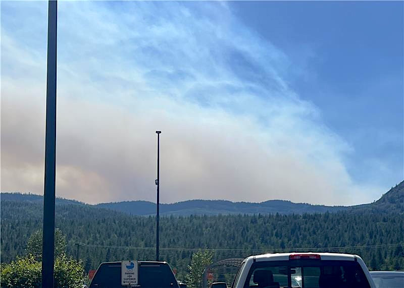
The location is south of Highway 3 between Christina Lake and Trail, and is being referred to as the “Hope Fire”.
Hope Fire burning near Northport, WA.
Map of Fire map image
The fire was first reported at approximately 1:15 p.m. was estimated later in the afternoon to be 600 acres (243 hectares) in size.
BC Wildfire said in a social media post that the US Department of Natural Resources is responding and have resources on-site. BC Wildfire has also deployed airtankers to support wildfire suppression efforts.
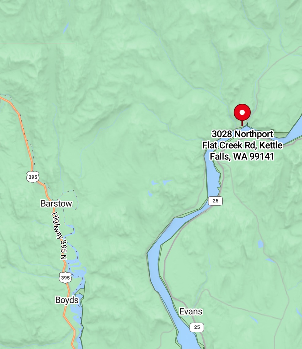
Stevens County Emergency Management map image
“At this time there is no threat to the Canada-US border,” it said.
Stevens County Emergency Management has announced Level 3 (LEAVE NOW) evacuation orders in the area of Three Pines Youth Camp, according to a statement from Stevens County Emergency Management.
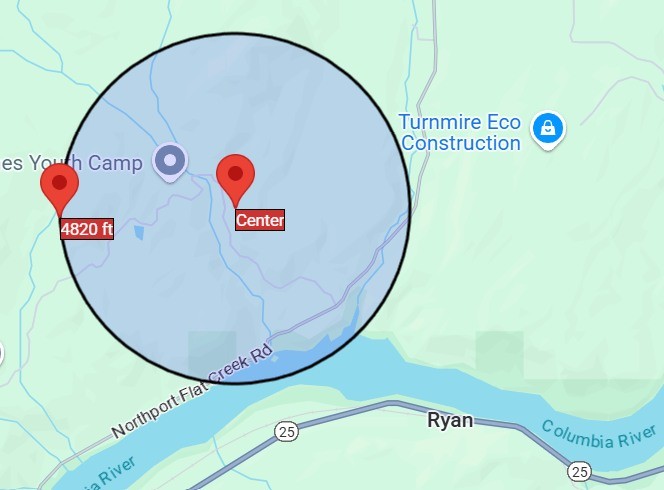
Stevens County Emergency Management map image


