By Times Chronicle Staff
UPDATES:
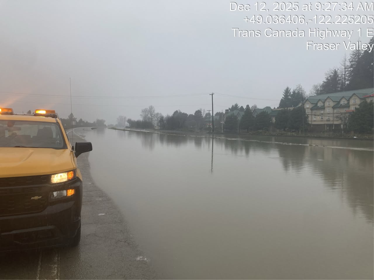
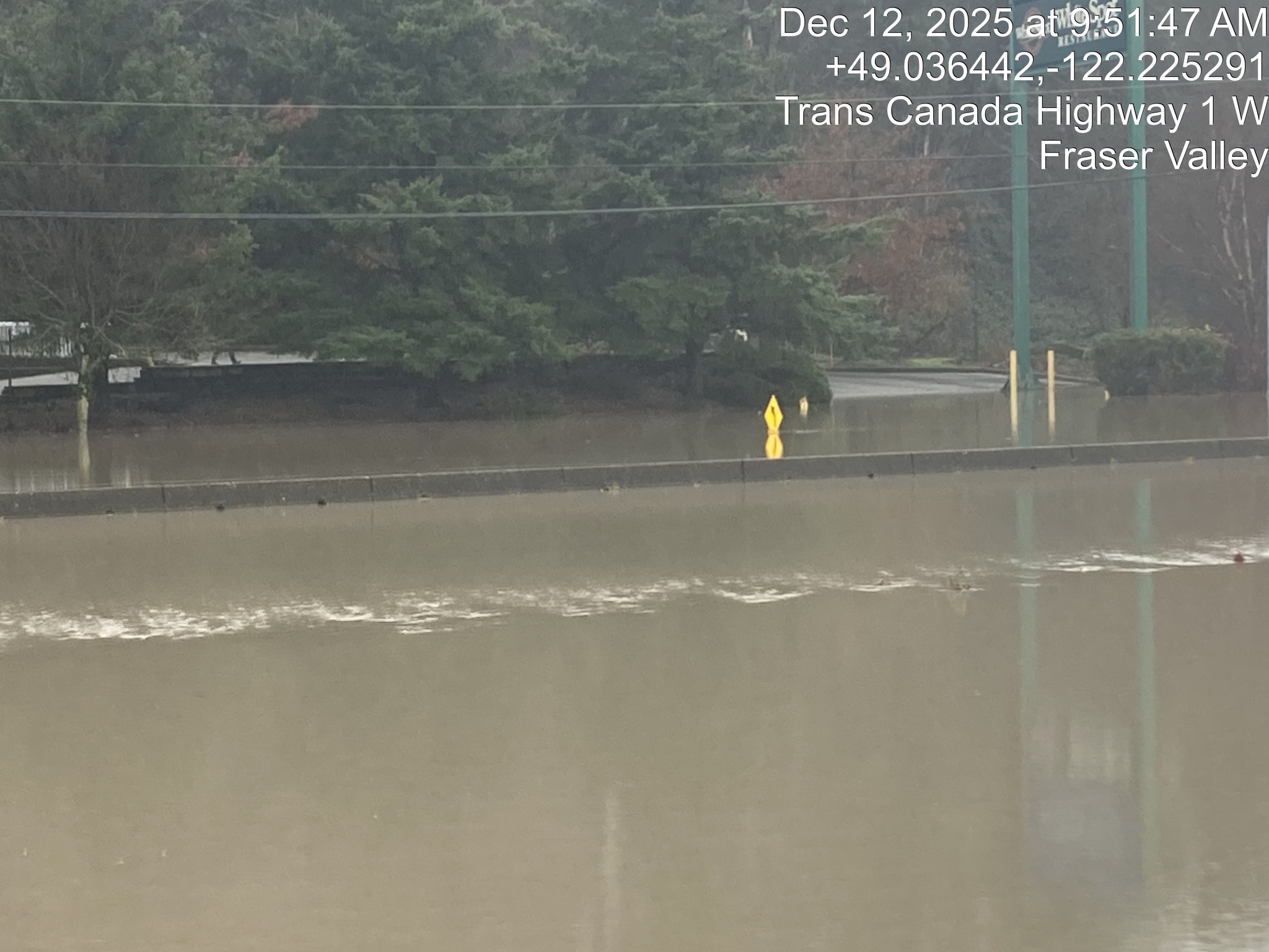
7:30 p.m. December 12, 2025 – There is currently no way through Abbotsford to Chilliwack or eastern parts of the province, according to the latest update from the Ministry of Transportation and Transit. Highway 1 remains closed in both directions through Abbotsford from Whatcom Road to No. 3 Road, as do the subsidiary side roads near the highway and through Sumas Prairie.
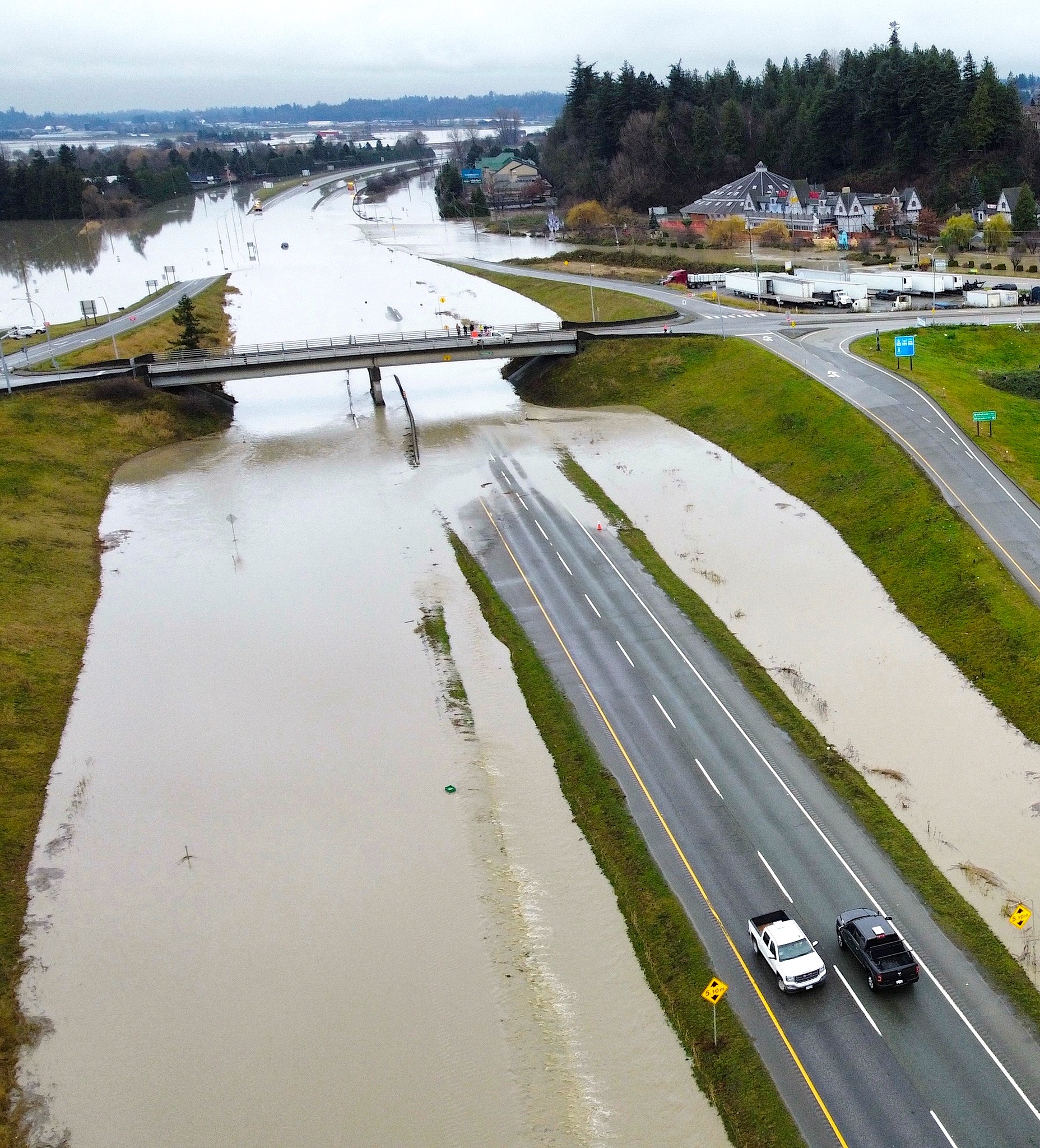
A flooded section of Hwy. 1 just outside of Abbotsford.
Ministry of Transportation and Transit photo
Current Highway Closures:
Highway 3 – CLOSED – Hope to East Gate (Manning Park) – 23 sights of serious damage include landslide, culvert blowouts, and road washouts. NOTE – Princeton to East Gate (Manning Park) is now open. Traffic control is still in place leaving Princeton advising of this.
Highway 1 – Highway 11 to No. 3 Road– Closed both directions
Sumas border – closed to commercial traffic, local traffic only. Border Services requests non-local traffic avoid Highway 11 / Sumas due to flooding and potential evacuation operations in Washington State.
Highway 1 – Highway 9 to Hope – Open to two way traffic. Eastbound traffic should expect to cross over to the west-bound lanes. Expect speed reductions.
Highway 7 fully REOPENED
Highway 1 – Canyon – Yale to Lytton – REOPENED
Highway 5 (Coquihalla) – Hope to Merritt – REOPENED – following flooding at Sowaqua.
Highway 99 – Mount Currie to Lilooett – REOPENED
Highway 8 – REOPENED
11:20 a.m. December 12, 2025 – Flooding at Whatcom Road area near Abbotsford forced Highway 1 closure between Exit 92 and Exit 104 (No. 3 Road) for approximately 12.5 km.
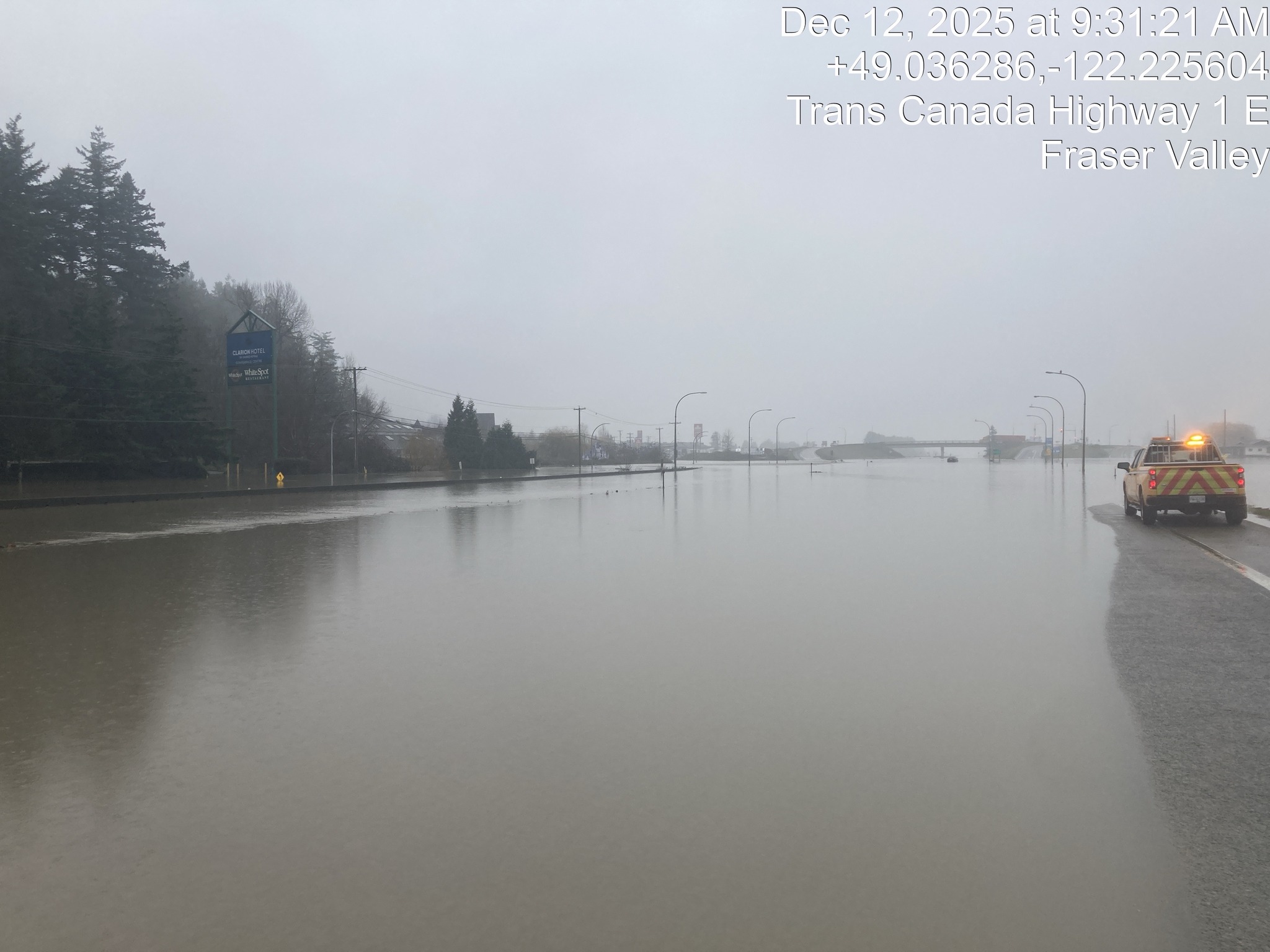
Ministry of Transportation and Transit photo
Ministry of Transportation and Transit photo
Ministry of Transportation and Transit photo
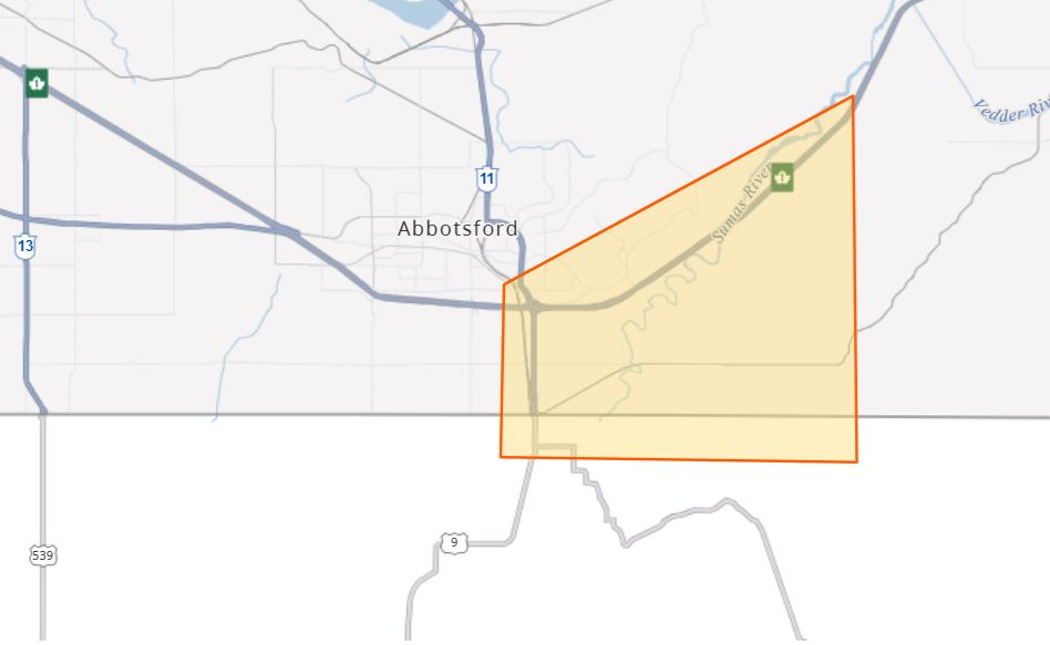
Ministry of Transportation and Transit graphic
9 a.m. December 12, 2025 – The River Forecast Centre is ending the Flood Warning for the Similkameen River tributaries including headwater tributaries at and upstream of Princeton and the Tulameen River. Rainfall has eased through the region with the Forecast Centre noting that rivers have reached peak levels and have now receded.
No significant additional rises are anticipated at this time and the River Forecast Centre continues to monitor the conditions and will provide updates as conditions warrant. For information on how to prepare for flood hazards, visit PreparedBC.
8:30 a.m. December 12, 2025 – Current Highway Closures
Highway 3 – CLOSED – Hope to Princeton – Debris on Highway
Highway 1 – Highway 11 to No. 3 Road – Closed both directions
Sumas border closed to commercial traffic, local traffic only – Border Services requests non-local traffic avoid Highway 11 / Sumas due to evacuation operations and flooding in Washington State.
Highway 1 – Highway 9 to Hope – Open to two way traffic. Eastbound traffic should expect to cross over to the west-bound lanes. Expect speed reductions.
Highway 7 – fully REOPENED
Highway 1 – Canyon – Yale to Lytton – REOPENED
Highway 5 (Coquihalla) – Hope to Merritt – REOPENED – following flooding at Sowaqua.
Highway 99 – Mount Currie to Lilooett – REOPENED
Highway 8 – REOPENED
____________________________
ORIGINAL:
Heavy rainfall from the atmospheric river that has been battering southern BC from the coast to further inland, affecting major highways between the Lower Mainland and the Interior.
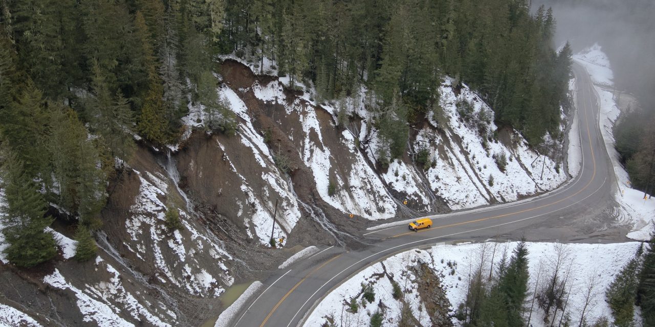
The Crowsnest Highway 3 between Hope and Manning Park remains closed from Wednesday (Dec. 10) evening.
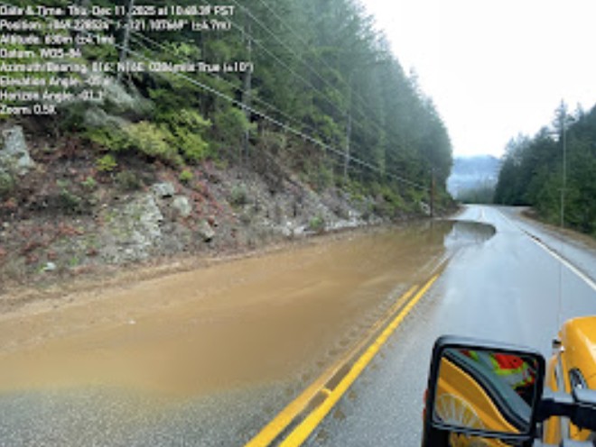
Hwy. 3 (exact location unspecified) – Ministry of Transport and Transit photo
“Our operational team, contractors, and engineering consultants have completed a full ground assessment of Highway 3 and confirmed extensive damage between Hope and Manning Park,” the Ministry of Transportation and Transit said.
It added that so far approximately 23 damaged sites have been identified, including flooding, rockfall, roadway debris, shoulder undermining, exposed or blocked culverts, areas of ponding water and high avalanche hazards.
“This situation is evolving and very dynamic. Please pay attention to any emergency messaging and traffic controls,” it urged. Updated road condition information can be found on DriveBC.ca .
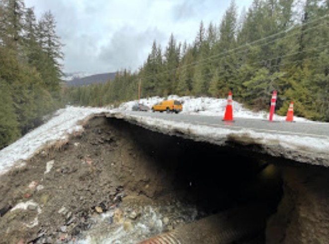
Hwy. 3 (exact location unspecified) – Ministry of Transport and Transit photo
As of 9 p.m. on Wednesday (Dec. 10), the following highways have the status:
Highway 7 fully REOPENED
Highway 1 – Canyon – Yale to Lytton – REOPENED
Highway 5 (Coquihalla) – Hope to Merritt – REOPENED – following flooding at Sowaqua.
Highway 99 – Mount Currie to Lilooett – REOPENED – Mount Currie to Lilooett
Highway 8 – REOPENED
Highway 1 – Highway 9 to Hope – Closed Eastbound
Highway 1 – Highway 11 to No. 3 Road– Closed both directions
Sumas border closed to commercial traffic, local traffic only
Border Services requests non-local traffic avoid Highway 11 / Sumas due to evacuation operations and flooding in Washington State.
Highway 3 – CLOSED – Hope to Princeton – Debris on Highway
There is no timeline for reopening those highways currently listed as closed. Drivers are cautioned that other provincial roadways could be closed with little or no notice.
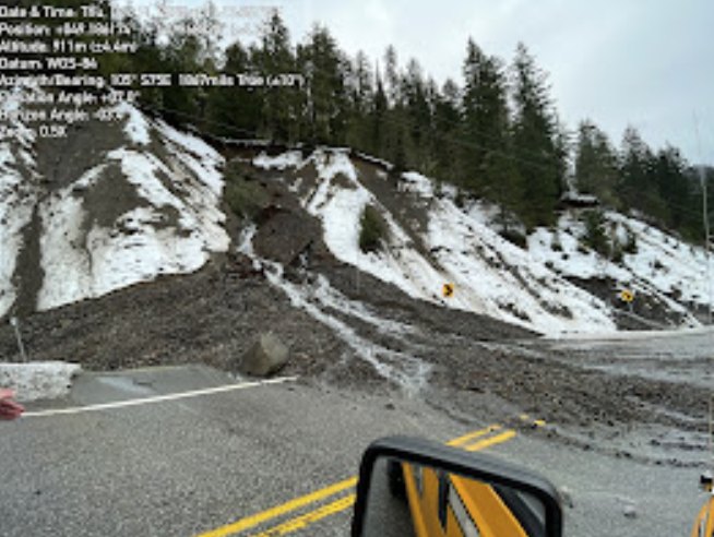
Hwy. 3 (exact location unspecified) – Ministry of Transport and Transit photo
The Fraser Valley Regional District (FVRD) has declared a local state of emergency and issued evacuation orders and alerts for properties along Wilson Road in the Chilliwack River Valley. Residents have been directed to leave immediately due to high flood risk.
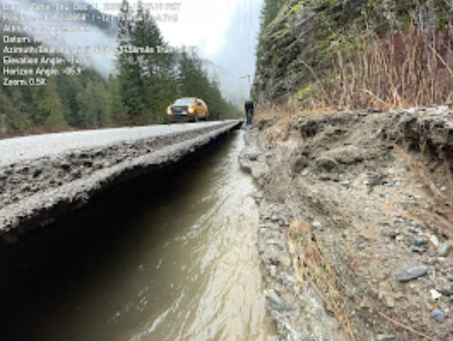
Hwy. 3 (exact location unspecified) – Ministry of Transport and Transit photo
A number of other alerts and orders and flood warnings are in place for the Fraser Valley, Abbottsford, Princeton. In the Similkameen the Regional District of Okanagan-Similkameen (RDOS) has issued an Evacuation Order for Chopaka located within Electoral Area “B” of the RDOS.
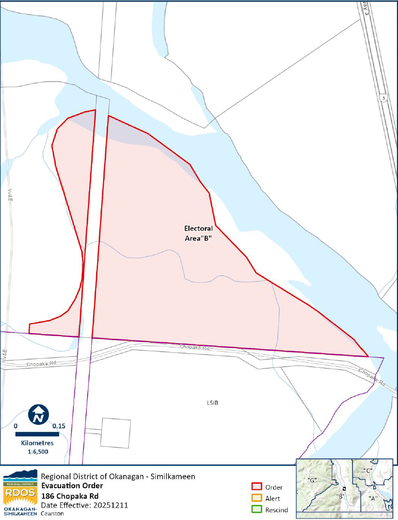
Evacuation Order in place for Chopaka from Dec. 11, 6 p.m.
RDOS image
Consult EmergencyInfoBC for more details.
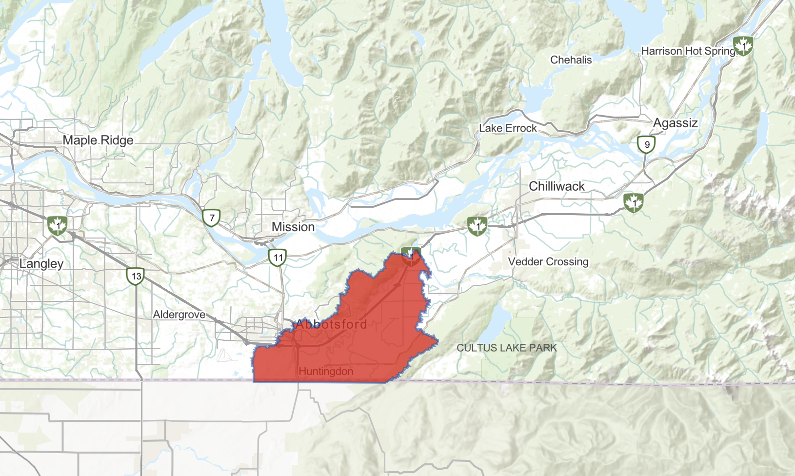
The River Forecast Centre is maintaining a Flood Warning for the Sumas River, including spillover from the Nooksack River in Washington State. The River Forecast Centre is ending a Flood Warning for the Lower Fraser tributaries including the Chilliwack River, Skagit River, Coquihalla River and other areas of the Fraser Valley around Abbotsford, Chilliwack, Hope and east through Manning Park.