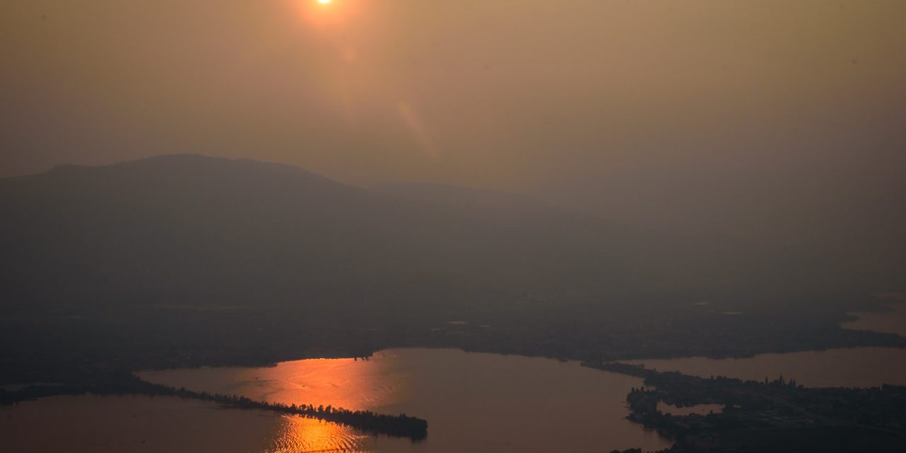
Smoke over Osoyoos has been a persistent problem this summer, but with a pattern change to cooler and damper weather, the risk of wildfires in B.C. should be reduced. (Richard McGuire file photo)
After a hot, dry summer of air filled with smoke, the weather in the South Okanagan is making an abrupt shift.
With autumn officially starting this year on Friday, Sept. 22, area residents can expect cooler-than-normal temperatures for the next while – along with some much-needed moisture. And this is likely to reduce the risk of wildfires.
That’s the word from meteorologists at The Weather Network following the release on Sept. 13 of their 2017 Fall Forecast.
“For the most part, it was a hot and dry summer across all of B.C., not just the South Okanagan,” said Erin Wenckstern, a meteorologist with The Weather Network in an interview with the Osoyoos Times.
“That is something that’s completely changed now,” she continued. “We’re seeing a pattern reversal across all of Canada. So the western parts of Canada are now getting cooler and more unsettled with precipitation and moisture coming back into the game, whereas Eastern Canada is finally getting a break.”
This switch, cooling the west and warming the east, is unlikely to last as long as the hot pattern in the summer. But, at least until October, the South Okanagan can expect cooler weather than normal for this time of year, Wenckstern said.
Then, heading into October, a high-pressure ridge is likely to bring warmer temperatures for the time of year back, she added.
“We do believe that the ridge over B.C. and over the northern Pacific may rebuild and push warmer temperatures back into the area,” said Wenckstern.
The change is caused by a number of different factors, but when fall comes, the wavelengths of the jet stream start to change and this can cause pattern reversals, she said.
Meteorologists have an easier time predicting temperatures than precipitation and the mountains of B.C. present special challenges for forecasters.
“Precipitation – especially once you’re heading towards the interior and all the valleys – is a little bit harder to forecast,” said Wenckstern. “It’s very hit and miss, but that being said, we are in a desirable pattern right now with a little bit more precipitation.”
Rainfall should be more normal, without the drought conditions seen over the summer or the flood conditions of the spring, she added.
“That’s good news for areas that are currently being impacted by the wildfires,” she said, adding that with cooler temperatures and more moisture, it should provide a chance to get some of the fires under control.
Wenckstern pointed out that fires have been burning across Western Canada and in the Northwest Territories, in addition to B.C., and those areas can also expect relief.
She points to the “30 Rule,” which though not exact science, is an indicator of how weather conditions affect the threat of wildfires.
According to this “rule,” conditions are more conducive to the spread of fire when temperatures are over 30 degrees Celsius, humidity is less than 30 per cent and winds are greater than 30 kilometres per hour.
Another factor that could influence weather later in the fall and into the winter is the potential developing of a weak La Niña pattern.
There’s a 55 to 60 per cent chance of this happening, said Wenckstern. It takes about five or six months to establish that we are into a La Niña cycle, she said, and a La Niña watch was only declared on Sept. 12.
“It’s a very hard thing to predict, especially because it’s very dependent on the ocean and atmosphere co-operating together,” she said.
Although she emphasizes that different La Niña patterns “have different personalities and different strengths,” they are typically associated with cold and snowy winters for most of Canada.
La Niña is an ocean-atmospheric phenomenon in which the surface temperature of the eastern equatorial Pacific Ocean is cooler than normal, affecting weather in North America.
RICHARD McGUIRE
Osoyoos Times


