By Times Chronicle Staff
Environment Canada has issued a Special Weather Statement warning of late season thunderstorms with the potential for “very strong wind gusts and locally heavy downpours”.
Wednesday morning is forecast to see increasing cloudiness with showers beginning near noon. Risk of a thunderstorm in the afternoon with wind from the south at 30 km/h gusting to 60 km/h.
The weather agency is warning of the potential for power outages, damage to buildings, vehicles from falling tree branches, flash flooding and generally hazardous driving conditions.
The weather alert has been issued for the Fraser Canyon, North and South Thompson, Nicola Valley, Similkameen, Okanagan Valley, Shuswap, Columbias, Kootenays, Yellowhead for Wednesday (Wednesday night for areas east of Golden and Creston towards the Alberta border).
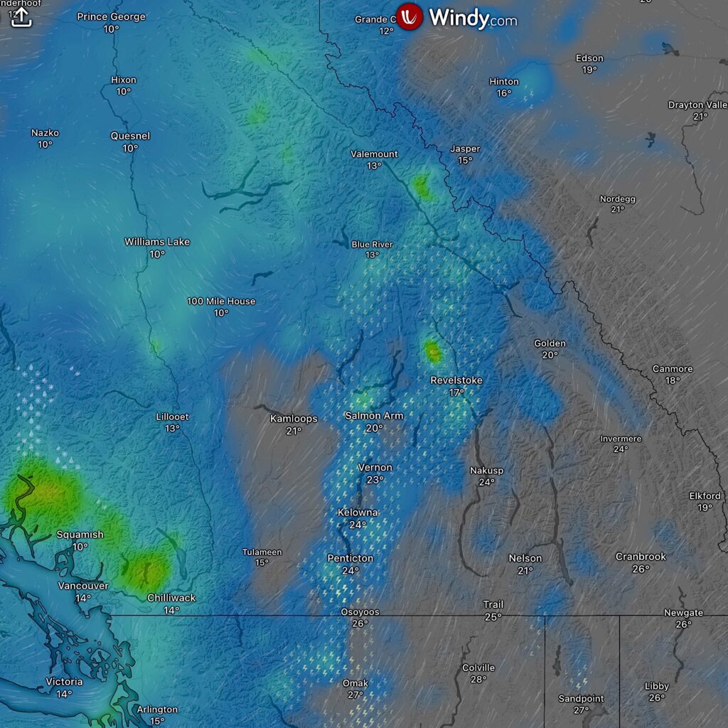
Thunderstorm activity forecast by Windy.com at 1 p.m. Wednesday Sept. 25.
According to the weather agency a “vigorous cold front” will cross the province on Wednesday bringing with it very strong winds aloft and an unstable airmass that it says is “ripe for the development of strong wind gusts, heavy showers and potentially thunderstorms.”
It adds that any thunderstorms that do develop will likely form a line resulting in the potential for repeated heavy downpours from multiple thunderstorms over the same area resulting in locally heavy rainfall totals.
“Damage to buildings, such as to roof shingles and windows, may occur and high winds may result in power outages, and fallen tree branches. Motorists, especially in high profile vehicles, may expect hazardous driving conditions on highways subject to strong crosswinds.”
Motorists are also being warned of potential strong crosswinds over high elevation highway passes susceptible to crosswinds.
Boaters and watercraft users are advised to be alert for sudden strong gusts over lakes.
It also highlighted that heavy downpours can cause flash floods and water pooling on roads. “Watch for possible washouts near rivers, creeks and culverts.”
There is also a heightened risk of debris flows over areas impacted by wildfire burn scars, it said.
It urged the public to continue to monitor alerts and forecasts issued by Environment Canada. To report severe weather, send an email to [email protected] or tweet reports using #BCStorm.


