This story was updated on Tuesday, August 23 to reflect the rescinding of all Evacuation Alerts due to the wildfire.
By Times Chronicle Staff
The Keremeos Creek wildfire continues to burn out of control, driven by topography and wind, according to the BC Wildfire Service (BCWS). The wildfire is now estimated to have covered 7,042 hectares.
The Regional District of Okanagan-Similkameen Emergency Operations Centre (RDOS EOC) has rescinded all Evacuation Alerts due to the Keremeos Creek wildfire as of August 23, 4 p.m. Twenty properties had remained on Evacuation Alert along Green Mountain Road and the northern end of Marron Valley Road since August 17.
“The RDOS would like to thank BC Wildfire, the structural fire teams that helped protect homes, Emergency Support Services volunteers and all the other groups that assisted local residents during this wildfire event,” the RDOS said in its update.
The fire is still considered ‘Out of Control’. Various amounts of rain fell across the fire area Sunday night and although thunderstorms developed in the area, the fire was not impacted.
“In many areas, forest fuels at high elevations are green, and the moisture content is preventing ignition and spread. Dead and fallen trees continue to burn at high elevations on steep slopes,” the BCWS said in its update on Monday, August 22.
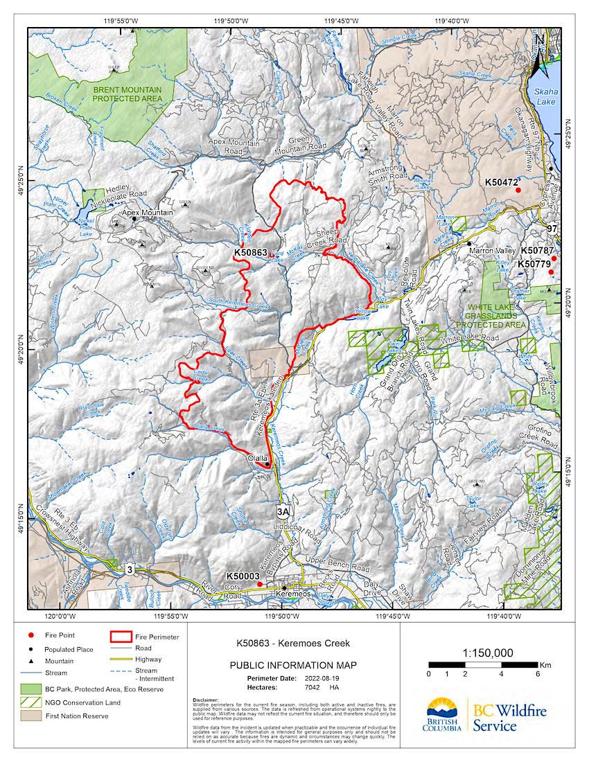
Keremeos Creek wildfire perimeter as of Aug. 19. BCWS graphic.
The fire remains stable along the western side of Highway 3A and a danger tree assessment is ongoing, BCWS said.
In the northwest, an additional helicopter pad has been established on the ridge top to expand access to areas where terrain continues to challenge operations.
North of Olalla Creek Road, crews continue to establish a fuel-free hose lay and extinguish hots spots identified on the thermal aerial scans. An updated aerial scan via drone was conducted Sunday night.
Mop-up and patrol continue throughout the western flank and along Green Mountain Road where there is minimal fire activity, the BCWS said.
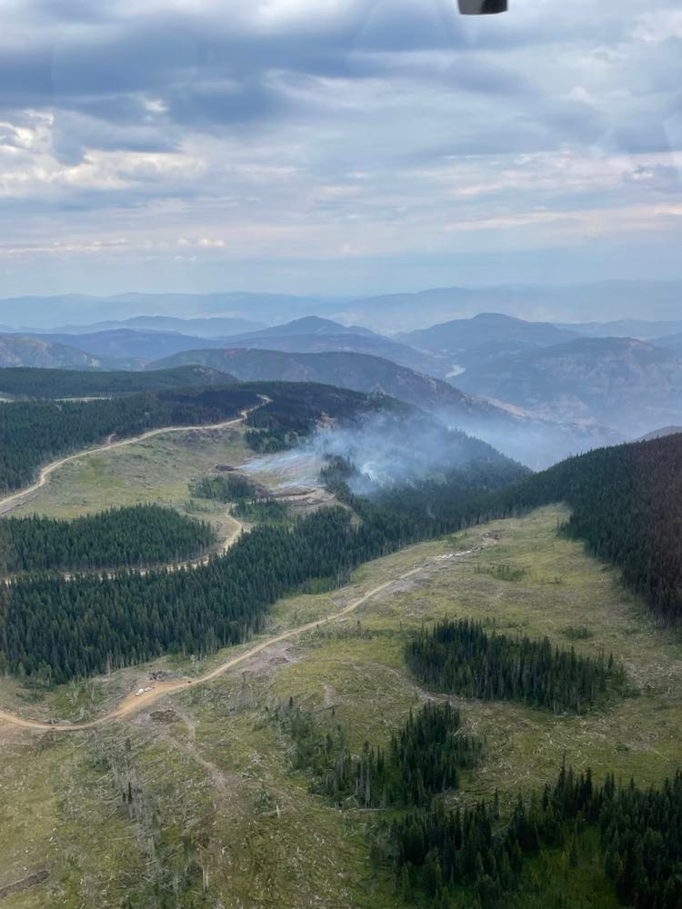
Fire activity in cut-block, north of Olalla FSR along the southwestern flank of the fire. Wind is pushing the fire inwards from the existing perimeter. BCWS photo.
Along the northwestern flank, crews established a hose lay to pump water upslope. Crews continue to use direct attack methods to extinguish hot spots from within the fire’s perimeter with the support of bucketing helicopters.
Mop up along the northeast flank of the fire continues. Crews have completed patrol and demobilized all equipment from Sheep Creek Road to Highway 3A, according to the BCWS.
It added that smoke will continue to be visible from Highway 3A and surrounding communities until there is significant rainfall, which is common with large wildfires.
Smoke appearing from well within the fire perimeter is expected. However, smoke that rises from green, unburned fuel or from outside of the fire’s perimeter should be reported. To report a wildfire or open burning violation, call 1-800-663-5555 toll-free or *5555 on a cellphone.


