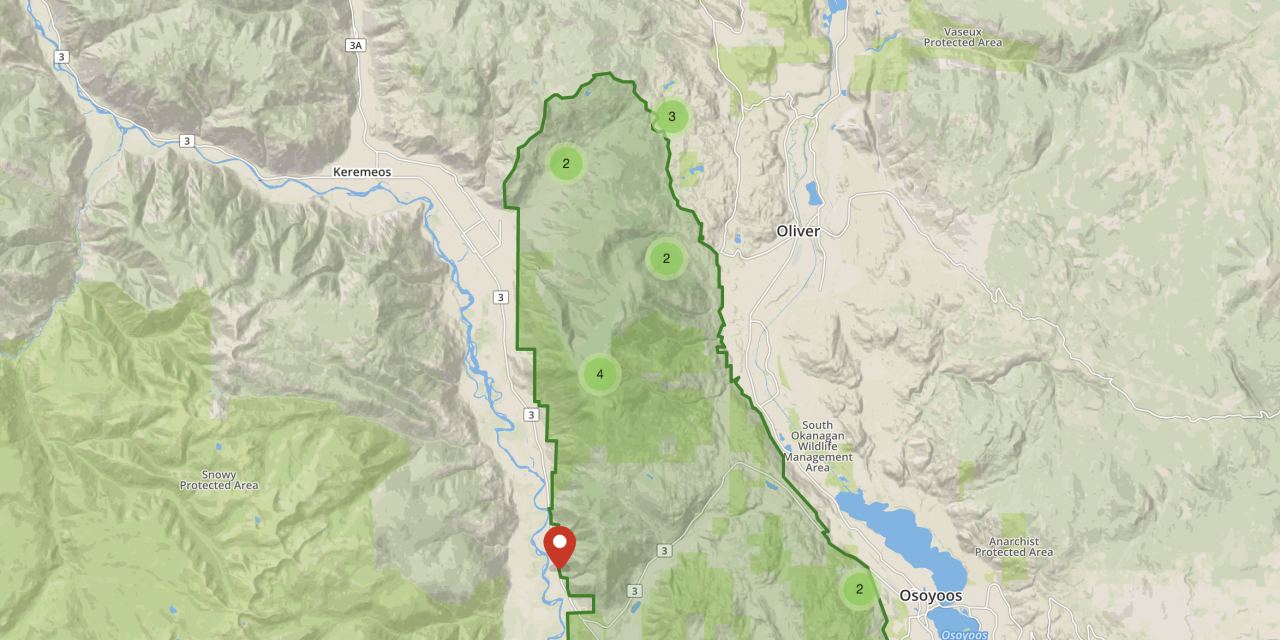

Parks Canada has released a working boundary for its proposed national park reserve. The boundaries include areas between Highway 3 and Highway 97. (Parks Canada)
By Vanessa Broadbent
Osoyoos Times
Parks Canada has released a map showing the working boundary it plans to work with for the proposed national park reserve in the South Okanagan-Similkameen region.
The area expands from the U.S. borer and expands to just north of Fairview Road. It also includes the area between Highway 3 and Highway 97.
Madden Lake and Burnell lake recreation sites in the Willowbrook area west of Oliver are not included within the boundaries.
The map was released last week with the along with Parks Canada’s launch of an online public consultation period for the park reserve.
Along with completing a survey, the public is able to pin locations on the map showing what activities they like to do within the boundaries.
Options range from sightseeing, camping and hiking to off road vehicle use, hunting and hang-gliding.
In a media call, Kevin McNamee, director of protected areas establishment for Parks Canada, said ranchers will be permitted to continue cattle grazing within the area.
• Read more: Parks Canada Launches Website And Survey For Public Consultation On Proposed National Park Reserve
Private meetings are planned with affected ranchers.
“The exact nature of how we would move forward to work with ranch community in respect to legislation is to be worked out,” he said.
As for a referendum, McNamee said the public consultation process isn’t intended to act as one.
“The consultation process is not a referendum or a vote on the idea of a national park reserve but rather what is more important, we believe, is for people to participate in this process to help shape what the national park reserve will look like in its boundary and use of lands,” he said.
However, Parks Canada is still inviting people to indicate if they’re in support or not of the a national park reserve
“We encourage any and all respectful comments,” McNamee said. “But what’s extremely helpful is indicating why it’s a yes or no. If we understand those concerns, we’re in a better position to shape the proposal.”
The map and survey can be viewed online at letstalksouthokanagansimilkameen.ca. Public input will be gathered until Feb. 28.