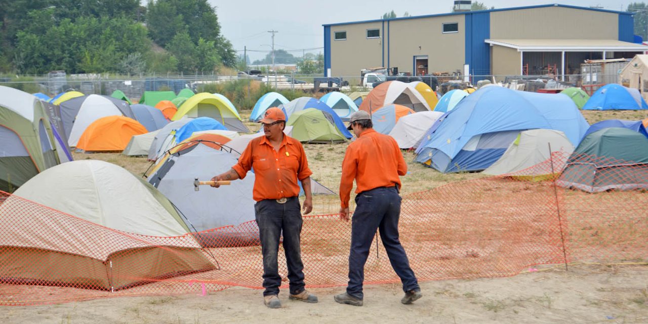
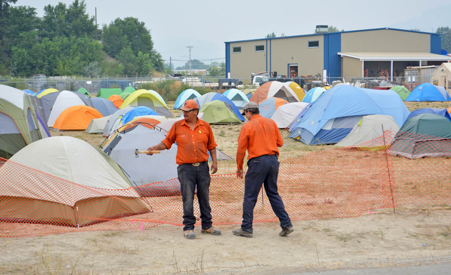
Two B.C. Wildfire Service personnel erect a fence around the fire camp on Maple Avenue in Oliver. Crews are working around the clock on the Testalinden Creek fire, which is still burning aggressively in the Tinhorn/Hester Creek area. The fire, spreading north, is more than 3,700 hectares and 60 per cent contained. (Lyonel Doherty photo)
Southerly winds have expanded the Testalinden Creek wildfire to more than 3,700 hectares, leading to an expansion of the area covered by the evacuation alert Thursday night.
The Regional District of Okanagan-Similkameen (RDOS) issued a notice late Thursday afternoon saying the evacuation alert now covers 285 homes and properties.
The fire has grown to the north and in the uplands of Kobau Mountain.
Properties recently added to the alert include those along Tinhorn Creek, Old Golf Course Road, West Avenue, Cellar Road, Chokecherry Lane, the west side of Sumac Street and portions of Fairview Road and Willowbrook Road.
Four properties falling under this expanded alert were recently evacuated due to the Wilson’s Mountain Fire. The Wilson’s Mountain evacuation alert was rescinded last week.
Meanwhile, the shifting winds have reduced the amount of heavy smoke from fires in Washington State, allowing an increased use of air support to assist in fighting local fires.
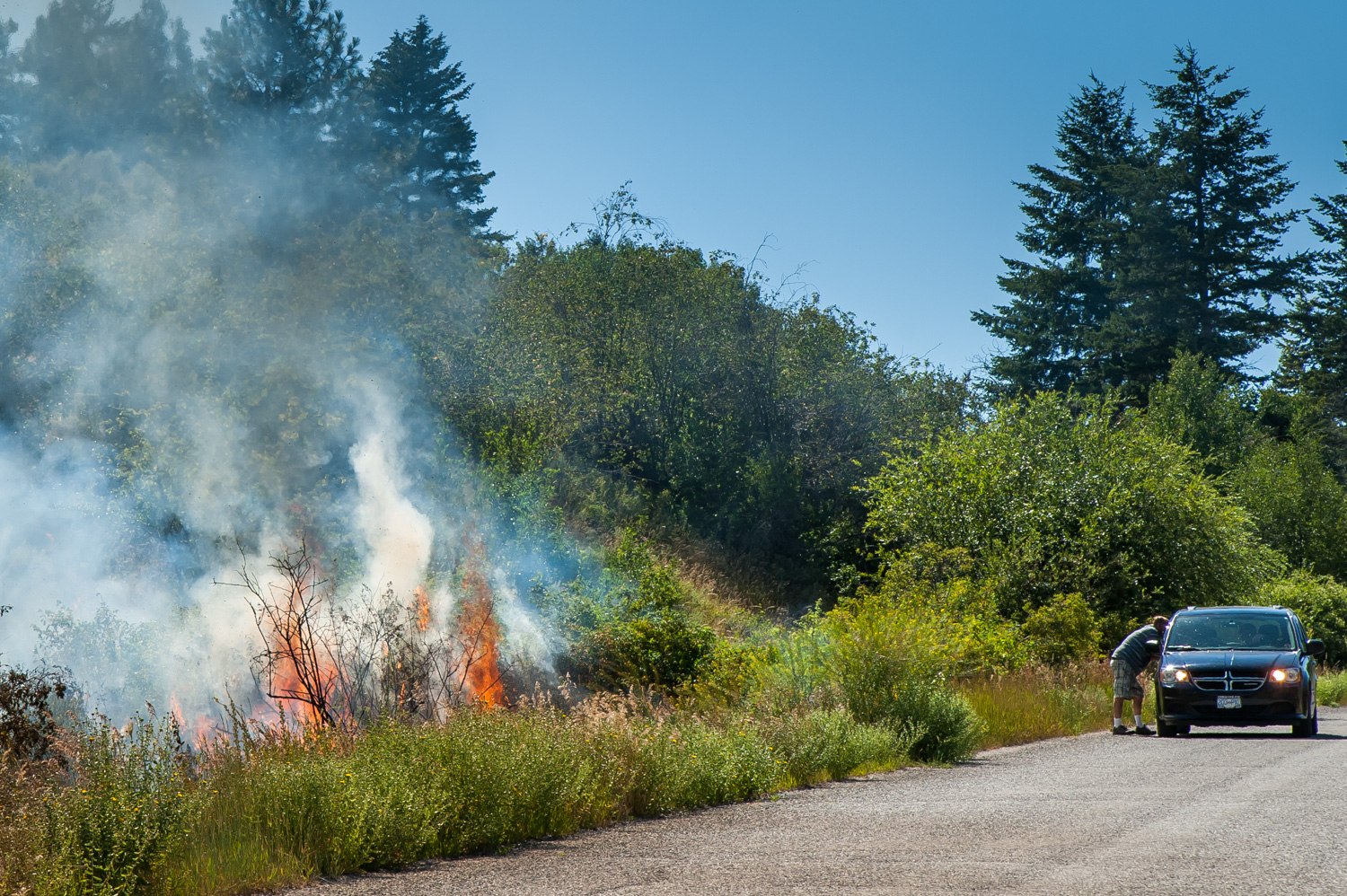
The winds also increased fire activity Thursday evening, with smoke and open flame visible from Oliver and along Highway 97, the B.C. Wildfire Service said.
Combustible material was burning on the slopes around Testalinden and Hester Creeks.
Gusty winds on Wednesday pushed the fire at its northwest flank north to the head of Tinhorn Creek.
As of Thursday night, there were 232 firefighters, 11 helicopters and 21 pieces of heavy equipment deployed at the Testalinden Creek fire.
Firefighters and equipment continue to work around the clock establishing containment lines, B.C. Wildfire Service said.
Crews are focusing efforts on strengthening northwest and north contingency lines along the Hester Creek drainage area. This includes controlled burning, with ignitions visible at night from Oliver.
Despite the forecast of rain in the coming week, possibly starting Friday, the fire danger rating in the Osoyoos area continues to range between high and extreme. Burning bans, including for campfires, remain in effect.
Meanwhile, other local fires at Wilson’s Mountain north of Oliver and Sidley Mountain east of Osoyoos continue to be active, but are no longer classed as wildfires of note and are essentially contained. Most of the Sidley Mountain fire was burning as the Nine Mile Fire in Washington State. That fire is in patrol and monitor status on the U.S. side.
Farther east, the Rock Creek is estimated at 4,534 hectares and is now 75 per cent contained. All evacuation orders were downgraded to alerts on Aug. 19.
Most of the smoke in Southern B.C. is coming from fires burning in Washington State, the largest being the Okanogan Complex in the Omak area.
That fire is now estimated at 122,306 hectares, the largest in state history. The fires have destroyed a confirmed 94 homes, with an estimated 5,140 homes threatened. An additional 63 non-residential structures were also destroyed.
With winds picking up, low humidity and high temperatures, an increase in fire activity was expected Friday.
Southerly winds were expected to help clear the smoke, making it possible for helicopters and air tankers to operate and make water and retardant drops, the Northwest Interagency Coordination Center (NWCC) said.
More than 1,774 fire personnel from 33 states are fighting the Okanogan fire or working to support the firefighting effort, NWCC said.
RICHARD McGUIRE
Osoyoos Times
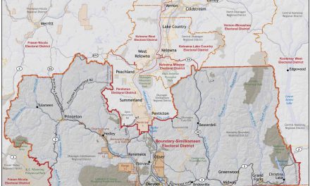
Smoke rises from Mount Kobau Thursday as the Testalinden Creek fire continued burning. In the foreground, burned grass is blackened near Kilpoola Estates. (Richard McGuire photo)


