By Madeline Baker, Times Chronicle
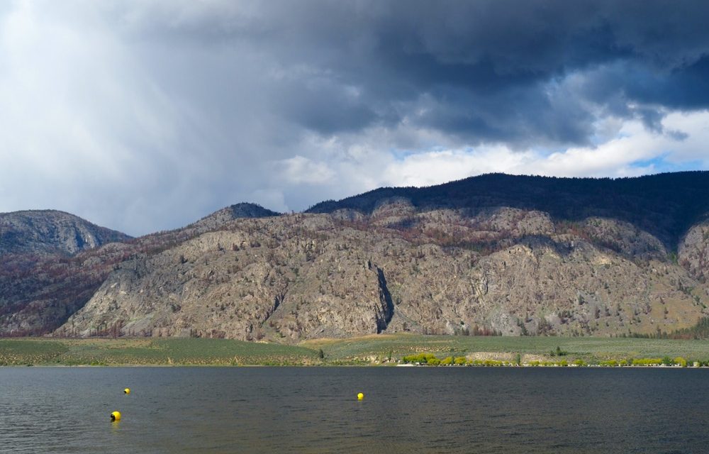
The Okanagan Basin Water Board met on February 9 to discuss, among other things, their initiatives to develop Okanagan climate indicators and bring new groundwater monitoring wells online near Osoyoos and Vernon, and their recently completed underwater elevation mapping of seven lakes in the area.
According to board member and Osoyoos Mayor Sue McKortoff, the board’s climate indicator pilot project was developed in the hopes that they could “future-proof the valley” to some degree by studying how weather has changed and continues to change in the valley.
Their areas of study will include changes in the snowpack and rainfall patterns, timing of inflows into local lakes, and overall growing season throughout the Okanagan Valley. The hope is that this information will allow local governments and residents to prepare both for major climate emergencies and more incremental changes to come.
The ongoing Okanagan Groundwater Monitoring Project, which the board began in partnership with the province in 2010, received an update at the February meeting where it was announced that two more groundwater monitoring wells will soon be brought online.
The two wells, one near Vernon and one west of Osoyoos, are part of a 15-well network that was developed between 2010 and 2013. They will help to bolster areas of research in which data has been lacking, which should in turn improve municipal decision-making around water supply.
Along with these new and ongoing projects, an underground elevation mapping project that was completed in 2021 has proven helpful to many organizations on many fronts and may even allow the OBWB to increase its invasive milfoil harvesting activity in Okanagan Lake.
Since they finished gathering the LiDAR (light imaging, detection, and ranging) data two years ago, the OBWB have had requests from local First Nations, governments, academic institutions and consultants to support their projects, which range from flood mitigation planning to identification of illegal buoys.
As McKortoff explained to Osoyoos council at their Feb. 14 meeting, it also revealed valuable information about the interactions between local species of mussels that are protected by the Province and invasive milfoil.
“At one point the Okanagan Basin Water Board was not allowed to use the invasive milfoil harvester because they wanted to protect the Rocky Mountain Ridged Mussel,” said McKortoff.
“We have some overhead shots of where the harvester had gone in and it didn’t make any difference to the mussels. We’re hoping that the province will listen to that.”
The board also approved a list of organizations to invite to the Okanagan Water Stewardship Council, their technical advisory body, for its next 18 month term beginning in April.
Finally, they received an advance preview of the short film highlighting their “Nk’Mip (Osoyoos Lake) Heart of the Watershed” water science forum in October. The film is available on their YouTube channel or can be purchased on DVD by e-mailing [email protected].

