By Lyonel Doherty
Oliver Chronicle
Regional district officials are breathing a bit easier in Oliver this week now that floodwaters are more manageable.
“There’s good (water) flow right now and no significant challenges,” said Community Services Manager Mark Woods.
Woods joined Jennifer Rice, parliamentary secretary for emergency preparedness in Penticton Wednesday for a media briefing on the local flooding situation.
Afterwards, he spoke to the Chronicle about the Sportsmen’s Bowl, Park Rill and Secrest Hill areas.
“It’s working . . . at this point the pumps are doing a good job; we’re monitoring it day by day.”
Woods said there is no need to breach Park Rill Road at this time because the pumping apparatus is doing what it is supposed to do.
However, if a large volume of water decides to overwhelm that area, they would have to pull the culverts out and breach the road, he pointed out.
Woods, who is working out of the Emergency Operations Centre, noted they have dealt with several blockages in Park Rill Creek, including two or three beaver dams.
Woods said he is a little surprised to see very little water flowing through the two new culverts under Highway 97 at Sportsmen’s Bowl Road. But they appear to be working well, he stated, adding the area is being monitored constantly.
“The neighbours are watching and will let us know if something is not working.”
Sportsmen’s Bowl Road is still under an evacuation order affecting 16 homes.
South of Oliver, plans are still being developed to improve water flow and drainage on Roads 6-9.
“We’re developing a strategy to get the water out of the low-lying areas,” Woods said.
On Secrest Hill Road, the water level has dropped significantly (six feet), he reported. (The road is still closed due to continued pumping.)
Elsewhere in the region, Woods noted that 17 homes remain on evacuation order in Tulameen. A state of local emergency has also been declared in Area B (Cawston) and Area D (Green Lake).
Last week a lot of emerging issues caused much grief in Oliver, Woods said. But this week there’s more breathing room.
“It’s still an emergency, and there are still real problems on Roads 6-9.”
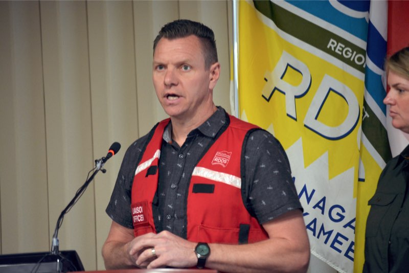
Community Services Manager Mark Woods answers questions during Wednesday’s media briefing on the flooding situation in the South Okanagan/Similkameen. (Lyonel Doherty photo)
During the media conference, Rice said they are monitoring what’s happening in the region and reducing the risk where they can.
But temperatures are expecting to increase, which will lead to more runoff, she pointed out.
Rice noted there are 11 evacuation orders across B.C. right now and 16 communities are under a state of emergency.
She added that more than two million sandbags have made there way to communities, and approximately 160 firefighters are assisting with sandbag operations.
“People are still recovering from last year’s floods and fires; no doubt it’s a trying time.”
But senior dam safety engineer Mike Noseworthy from the Ministry of Forests said monitoring has improved a lot since the Testalinda mudslide in 2010.
“All the dams here are in good shape and we’re not worried about them failing.”
It was noted at the media briefing that disaster financial assistance (up to a maximum of $300,000) is available to eligible homeowners impacted by flooding. For more information, visit www.gov.bc.ca/disasterfinancialassistance.
The regional district has released a video from drone footage that shows flooded sites in Oliver and other rural areas. In it, water resources engineer Don Dobson says you cannot forecast flood crises. For example, last year people forecast a drought and look what happened – floods.
“There was no way that we could predict what was going to happen this year, although we are starting to see a pattern of wetter winters and deeper snow packs.”
Is this part of a changing climate?” Dobson asks.
“It could very well be, but three years does not necessarily mean a trend, but certainly we are suffering from the impacts of something that’s been going on for more than just one year.”
Dobson also suspects that wildfires in B.C. have changed the hydrology of the province’s watersheds.
An information centre for flooding is opening for several hours daily at MLA Linda Larson’s Oliver office, located at 6369 Main Street.