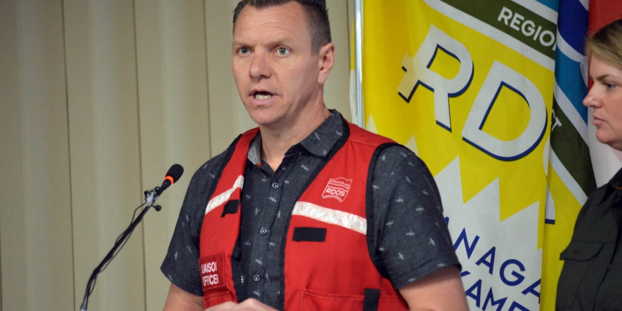

Community Services Manager Mark Woods addresses the media on the flooding situation during a conference in Penticton on Wednesday. (Lyonel Doherty photo)
While much talk of flooding has focused on Oliver and other parts of the regional district, Mother Nature has not ignored Osoyoos.
Area A director Mark Pendergraft said rural Osoyoos has its own flooding issues, however, not as extensive as Area C (rural Oliver).
He noted that some rural Osoyoos homeowners are getting water in their basements, adding that driveways are underwater near some streams and kettle lakes.
“I wouldn’t go so far as to say we have been lucky down here as there is still lots of snow to melt and one never knows.”
Pendergraft said flooding around Osoyoos Lake is a potential if the Similkameen tributaries get too high.
Osoyoos Mayor Sue McKortoff said she attended a meeting at the regional district office regarding the flooding situation.
“Certainly Oliver is having a terrible time, and we are not … yet. The lake continues to rise daily and we have sand and sandbags being filled and used.”
McKortoff said the next four to six weeks will see dramatic changes in the Osoyoos area as the freshet gets underway.
During a media briefing in Penticton on Wednesday, MLA Jennifer Rice, parliamentary secretary for emergency preparedness in B.C., said they are monitoring what’s happening in the region and reducing the risk where they can.
But temperatures are expecting to rise, which will lead to more runoff, she pointed out.
Rice noted there are 11 evacuation orders across B.C. right now and 16 communities are under a state of emergency.
She added that more than two million sandbags have made there way to communities, and approximately 160 firefighters are assisting with sandbag operations.
“People are still recovering from last year’s floods and fires; no doubt it’s a trying time.”
Mark Woods, community services manager for the regional district, said 17 homes remain on evacuation order in Tulameen. A state of local emergency has also been declared in Area B (Cawston) and Area D (Green Lake). The latest community to be placed on evacuation alert is Twin Lakes.
North of Osoyoos, the area between Road 9 and 6 is a real problem, Woods said, referring to the flooding and drainage issues that officials are dealing with.
Senior dam safety engineer Mike Noseworthy from the Ministry of Forests said dam monitoring has improved a lot since the Testalinden mudslide in 2010.
“All the dams here are in good shape and we’re not worried about them failing.”
It was noted at the briefing that disaster financial assistance (up to a maximum of $300,000) is available to eligible homeowners impacted by flooding. For more information, visit www.gov.bc.ca/disasterfinancialassistance.
The regional district has released a video from drone footage that shows flooded sites in the district. In it, water resources engineer Don Dobson says you cannot forecast flood crises. For example, last year people forecast a drought and look what happened – floods, he says.
“There was no way that we could predict what was going to happen this year, although we are starting to see a pattern of wetter winters and deeper snow packs.”
Is this part of a changing climate?” Dobson asks.
“It could very well be, but three years does not necessarily mean a trend, but certainly we are suffering from the impacts of something that’s been going on for more than just one year.”
Dobson also suspects that wildfires in B.C. have changed the hydrology of the province’s watersheds.
The man in charge of B.C.’s River Forecast Centre is “cautiously optimistic” that flooding may soon level off.
On Thursday during a media conference call, David Campbell from the River Forecast Centre and Shaun Reimer, who oversees water levels in Okanagan Lake, gave an update on the flooding outlook.
Campbell said last week’s exceptionally warm weather kick-started the flooding season by rapidly melting snow at mid-elevations (1,000 to 1,500 metres).
He noted that one-third to one-half of the snow has melted at mid-elevation. But he pointed out that the snow at higher elevations has just started to melt.
Campbell said temperatures have cooled off over the last few days, which has resulted in water flows easing up. He wouldn’t say the flood situation has stabilized, but noted he is “cautiously optimistic” that it has leveled off (for now) or will soon taper off. But again, he casts a wary eye to the higher elevation snow pack that has yet to melt.
Campbell said the forecast calls for less extreme warm temperatures, however, there’s a potential for a longer period of warmer weather.
“We may see rain next week, so we could see increased pressure on our rivers.”
Reimer agreed there is a lot of snow left to melt in the mountains, so there could be some aggressive outflows as a result.
“We hope to see a gradual melt,” he said.
LYONEL DOHERTY
Special to the Times


Water table is so full that it’s seeping up through the ground.
Town imposes water restrictions because of low water table.
The need for restrictions are unverified to the public. All we know is that it’s costing the town more as the pumps burn out due to excessive watering due to everyone consuming more water due to the restrictions.
Might be time for a mayor and council who don’t have an ‘alternative’ agenda on the towns water usage.