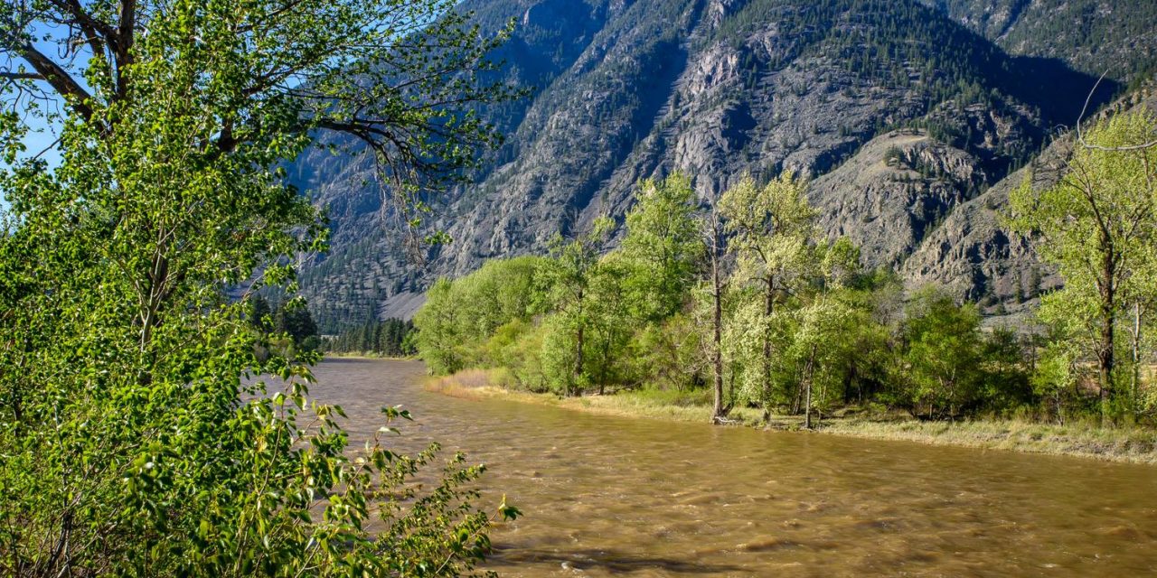
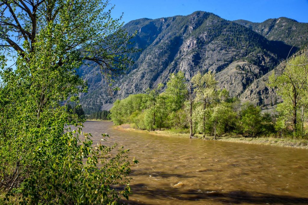
Water levels on the Similkameen River are high right now, even though snowpack levels were just slightly above normal at the start of April. Snowpack in the Okanagan, however, was at its second highest level in 30 years, even though most of the snow was only at upper elevations. The early warm weather, like last year, caused an early runoff, which may leave streams depleted later in the season. (Richard McGuire photo)
With warm temperatures this spring, snowpack is melting faster than usual, but this year there’s more snow than last year at higher elevations.
All that adds up to uncertainty among the experts as they try to forecast the possibility of floods, droughts and wildfires later this spring and into the summer.
At a webinar hosted last Friday by the Okanagan Basin Water Board (OBWB), provincial and federal government experts discussed weather trends, snowmelt, river and lake flows, groundwater supply and fire preparedness.
Snowpack at higher elevations is actually at the second highest volume seen in the last 30 years, second only to 1999, said Dave Campbell, section head at the B.C. River Forecast Centre.
The problem though is that most measurements are taken at upper elevations, but snow is virtually gone at middle and lower elevations, below 1,200 metres, he said.
The early melt due to the warmer weather filled lakes and reservoirs sooner, and with warm temperatures predicted during the remainder of April, rapid melting will continue.
“It’s highly anomalous compared to things that we’ve seen in the past,” said Campbell. “We’re trying to deal with some of those uncertainties around the impact of having lost that water at the lower elevations.”
Last year at this time, upper level snowpacks were much lower than average. This year, however, the April 1 Snow Survey and Water Supply Bulletin issued by the River Forecast Centre shows the Okanagan at 131 per cent of normal and the Similkameen slightly above normal at 104 per cent.
Conditions for a drought declaration are unlikely to be met this year for Osoyoos Lake, said Anna Warwick Sears, OBWB executive director, who is now a member of the International Osoyoos Lake Board of Control.
A drought is declared if certain criteria relating to water flows are met both on the Similkameen River at Nighthawk and on Okanagan Lake.
These conditions have not been met.
While these drought conditions weren’t met early last year either, the board of control obtained a special allowance from the International Joint Commission (IJC) as drought conditions worsened at the end of July.
In a drought year, the level of Osoyoos Lake can be raised or lowered at the Zosel Dam in Oroville to six inches above or below the normally permitted range in order to manage water.
Meanwhile, the weather trends that dominated last year have gone or are disappearing, according to Lisa Coldwells, a warning preparedness meteorologist with Environment Canada.
Last year, a large area of warm Pacific Ocean water southwest of Vancouver Island, popularly known as “The Blob,” affected weather patterns through much of the year, contributing to the drought.
Another influence, especially over the winter, was El Niño, caused by ocean currents in the equatorial Pacific.
“The Blob is not going to be a player this coming spring,” said Coldwells, adding that although El Niño was still there at the beginning of the spring, its impact is diminishing.
B.C. is expected to continue to experience temperatures above normal this spring, she said.
A high-pressure ridge will keep conditions warm and dry to the end of April, she added.
Shaun Reimer, who manages water levels on Okanagan Lake and the Okanagan River with the dam at Penticton, said inflows into Okanagan Lake are similar this year to last.
The early melt both years has meant that inflows are much higher than normal, he said. The current lake level, he added, is about a centimetre lower than at this time last year.
The uncertainty caused by the early snowmelt makes it difficult to determine which way to go with lake level management, Reimer said.
He added that he also must take into account sockeye salmon eggs in the river to ensure that water discharges don’t harm them.
David Thomson presented information on groundwater observation wells collected by the B.C. Ministry of Environment and FLNRO. Most of these wells show water levels close to historic maximums, although some have only been in operation a few years.
This includes an observation well on Anarchist Mountain, which tends to fluctuate with the season.
Finally Ray Crampton, a FLNRO director for Okanagan Shuswap, spoke about the wildfire outlook for the coming season.
Last year was an especially bad fire season, he said, both because of the impact of El Niño and because bad fire seasons tend to come in cycles of every four or five years.
Last year there were 1,800 wildfires, which burned more than 300,000 hectares, Crampton said.
“That was one of the worst fire years, if not the worst year, since 2003,” he said, adding half the fires were caused by people and the other half were caused naturally.
This year there have already been 61 fires in B.C., burning more than 852 hectares, Crampton said.
Over the longer term, the forecast is that the fire situation will get back to average, he said.
“That’s reassuring news to me, but again it’s a long-range forecast and things can change.”
He also commented on drought preparation.
“We may well see the snow pillows exhausted again prematurely,” said Crampton. “That causes streams to go dry sooner and stay dry longer.”
The result, he said, could still mean floods, drought and fire.
RICHARD McGUIRE
Osoyoos Times
